Río Negro (Uruguay)
The Río Negro (Black River) is the most important river in Uruguay. It is a left tributary of the Uruguay river. It starts in southern Brazil and flows west across the entire width of Uruguay to the Uruguay River.
| Río Negro | |
|---|---|
 The Río Negro river at Paso del Puerto | |
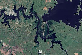
 Course of the Río Negro river | |
| Location | |
| Country | Brazil, Uruguay |
| Physical characteristics | |
| Source | |
| - location | Bagé, Rio Grande do Sul, Brazil |
| - coordinates | 33°25′34″S 58°24′32″W / 33.42611°S 58.40889°W |
| Mouth | |
| - location | Río Negro Department, Uruguay |
| - coordinates | 33°25′34″S 58°24′32″W / 33.42611°S 58.40889°W |
| Length | 750 km (470 mi) |
| Basin size | 70,714 km2 (27,303 sq mi) |
| Discharge | |
| - location | Palmar Dam |
| - average | 722 m3/s (25,500 cu ft/s) |
| Basin features | |
| Tributaries | |
| - left | Yí |
| - right | Tacuarembó |
The course of the Río Negro across Uruguay effectively divides the south of the country from the north.
Geography
changeThe Río Negro is 750 kilometres (466.0 miles) long. Its drainage basin covers 70,714 km2 (27,303 sq mi), most of it in territory of Uruguay; only 2,500 km2 (965 sq mi) are in Brazil.
Its average yearly discharge (volume of water which passes through a section of the river per unit of time) is 226 m3/s (8,000 cu ft/s) (70 years) at the Palmar dam, 72 km (45 mi) to the east of the city of Mercedes, Soriano department.[1]

Average monthly discharge (m3/s) at Palmar
Course
changeThe Río Negro starts in the Bagé municipality, Rio Grande do Sul state, Brazil. It flows from northeast to southwest through Uruguay and divides the country in two parts: the northern part with 6 departments and the southern part (slightly larger) with the 13 remaining departments.
Its course forms the border of the departments:
- On its northern (right) side: Rivera, Tacuarembó and Río Negro.
- On its southern (left) side: Cerro Largo, Durazno, Flores and Soriano.
At its end, to the south of the city of Fray Bentos in the Río Negro department, the Río Negro flows into the Uruguay river as a left tributary. The river has many meanders along its course and three hydroelectric dams has been built on this river that form three artificial lakes (or reservoirs in this case), from northeast to southwest:
- Rincón del Bonete Reservoir, also called the Gabriel Terra Reservoir or the Río Negro Reservoir;
- Baygorria Dam; and the
- Palmar or Constitution Dam.
The main cities along the river:
- Tacuarembó department
- Soriano department
- Mercedes, capital of the department.
- Villa Soriano, one of the oldest towns of Uruguay; it is near the mouth of the Río Negro river.
Main tributaries
changeThe main tributaries of the Río Negro are:
|
Left tributaries:
|
|
Right tributaries:
|
Gallery
change-
 Flooding of the Mercedes city.
 -
 Flooding along the Rio Negro.
 -
 The Yí river.
 -
 Tacuarembó river.


Related pages
changeReferences
change- ↑ "GRDC - Le Río Negro - Station: Palmar". UNH / GRDC. Retrieved 7 August 2017.