Sumburgh Airport
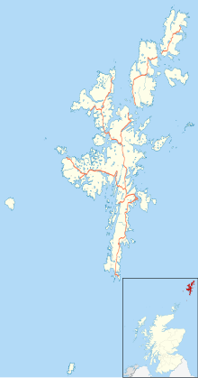
Sumburgh Airport [3] is the main airport connecting the Shetland Islands with mainland Scotland. It is on the southernmost tip of Shetland, 17 nautical miles (20 miles or 31 km) south of Lerwick.[1]
Sumburgh Airport | |||||||||||||||
|---|---|---|---|---|---|---|---|---|---|---|---|---|---|---|---|
 Sumburgh Airport (2014) | |||||||||||||||
| Summary | |||||||||||||||
| Airport type | Public | ||||||||||||||
| Owner/Operator | Highlands and Islands Airports Limited (HIAL) | ||||||||||||||
| Serves | Shetland | ||||||||||||||
| Location | Sumburgh, Shetland, Scotland | ||||||||||||||
| Elevation AMSL | 21 ft / 6 m | ||||||||||||||
| Coordinates | 59°52′53″N 01°17′38″W / 59.88139°N 1.29389°W | ||||||||||||||
| Website | Sumburgh Airport | ||||||||||||||
| Map | |||||||||||||||
| Runways | |||||||||||||||
| |||||||||||||||
| Helipads | |||||||||||||||
| |||||||||||||||
| Statistics (2018) | |||||||||||||||
| |||||||||||||||
The airport is unusual in that it has a 550 metre helicopter runway instead of the usual helipad. The western end of runway 09 crosses the A970 road between Sumburgh and the northern mainland; access is controlled by a level crossing with barriers lowered whenever a flight is taking off or landing.
HIAL receives subsidies from the Scottish Ministers in accordance with Section 34 of the Civil Aviation Act 1982. Annual Reports and Accounts are submitted to the Scottish Ministers.
Sumburgh was a former RAF airfield, with two runways. It saw regular action in World War II. 404 Squadron operated Beaufighter Mark VI and X aircraft from this station on coastal raids against Axis shipping off the coast of Norway and in the North Sea.
References
change- ↑ 1.0 1.1 "NATS - AIS - Home". Archived from the original on 27 March 2012. Retrieved 18 May 2016.
- ↑ "UK airport data: Tables 3, 9 and 13.pdf". UK Civil Aviation Authority. Retrieved 8 April 2019.
- ↑ (IATA: LSI, ICAO: EGPB)
