Whanganui River
major river in the North Island of New Zealand
The Whanganui River is a major river in the North Island of New Zealand. It is 290 kilometres (180 mi) long and is the third-longest river in New Zealand. It has special status owing to its importance to the region's Māori people. In March 2017 it became the world's first river to be given its own legal identity, with the right of legal person.
| Whanganui River Whanganui | |
|---|---|
 The Whanganui River. | |
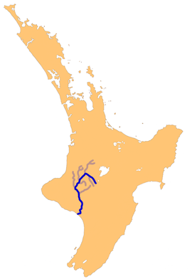
 The Whanganui River system | |
| Location | |
| Country | New Zealand |
| Region | Manawatū-Whanganui |
| Towns and cities | Taumarunui, Whanganui |
| Physical characteristics | |
| Source | Mount Tongariro |
| Mouth | Tasman Sea |
| - coordinates | 39°56.89′S 174°59.22′E / 39.94817°S 174.98700°E |
| - elevation | Sea level |
| Length | 290 km (180 mi) |
| Basin size | 7,380 km2 (2,850 sq mi) |
| Discharge | |
| - average | 219 m3/s (7,700 cu ft/s)[1] |
| Basin features | |
| Tributaries | |
| - left | Whakapapa River, Retaruke River, Manganui o te Ao River |
| - right | Pungapunga River, Ongarue River, Ohura River, Tangarakau River, Whangamōmona River |
The river source is on the north-western side of Mount Tongariro. The river flows to the north-west before turning south at Taumarunui. It reaches the seat at Whanganui.