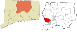
Farmington, Connecticut
town in Hartford County, Connecticut, United States
Farmington is a town in Hartford County in the Farmington Valley area of central Connecticut in the United States. The population was 26,712 at the 2020 census.[2]
Farmington, Connecticut | |
|---|---|
 Farmington, Connecticut by drone, May 2020 | |
| Motto(s): "Respecting History, Planning The Future"[1] | |
| Coordinates: 41°43′40″N 72°50′25″W / 41.72778°N 72.84028°W | |
| Country | |
| U.S. state | |
| County | Hartford |
| Region | Capitol Region |
| Settled | June 1640 |
| Incorporated | December 1645 |
| Consolidated | 1947 |
| Area | |
| • Total | 28.8 sq mi (74.5 km2) |
| • Land | 28.0 sq mi (72.6 km2) |
| • Water | 0.8 sq mi (2.0 km2) |
| Elevation | 161 ft (49 m) |
| Population (2020)[2] | |
| • Total | 26,712 |
| • Density | 930/sq mi (360/km2) |
| Time zone | UTC−5 (Eastern) |
| • Summer (DST) | UTC−4 (Eastern) |
| ZIP Codes | 06032, 06085 |
| Area code(s) | 860/959 |
| FIPS code | 09-27600 |
| GNIS feature ID | 0213430 |
| Interstates | |
| U.S. Highways | |
| State Routes | |
| Website | www |
References
change- ↑ "Town of Farmington Connecticut". Town of Farmington Connecticut. Archived from the original on May 3, 2009. Retrieved September 22, 2012.
- ↑ 2.0 2.1 "Census - Geography Profile: Farmington town, Hartford County, Connecticut". United States Census Bureau. Retrieved December 15, 2021.

