Loing
The Loing is a river in central France. It is a left tributary of the Seine. It flows through three regions of France: Bourgogne-Franche-Comté, Centre-Val de Loire and Île-de-France
| Loing | |
|---|---|
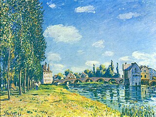
 Loing River; painted by Alfred Sisley | |
 | |
| Location | |
| Country | France |
| Physical characteristics | |
| Source | |
| - location | Burgundy |
| - coordinates | 47°33′13″N 3°13′51″E / 47.55361°N 3.23083°E |
| - elevation | 320 m (1,050 ft) |
| Mouth | |
| - location | Seine |
| - coordinates | 48°23′13″N 2°48′9″E / 48.38694°N 2.80250°E |
| - elevation | 45 m (148 ft) |
| Length | 143 km (89 mi) |
| Basin size | 4,150 km2 (1,600 sq mi) |
| Discharge | |
| - average | 19 m3/s (670 cu ft/s) |
| Basin features | |
| Progression | Seine→ English Channel |
Geography
changeThe Loing is 142.7 kilometres (88.7 miles) long. Its drainage basin covers 4,182 square kilometres (1,615 square miles).[1]
Its average yearly discharge (volume of water which passes through a section of the river per unit of time) is 18.50 m3/s (653 cu ft/s) at Épisy, Seine-et-Marne, at about 10 km (6.2 mi) from the mouth of the Loing.[2]

Average monthly discharge (m3/s) at Épisy (69 years)
Course
changeThe Loing starts in Puisaye, a natural region, in the commune of Sainte-Colombe-sur-Loing, in the south of the Yonne department, Bourgogne-Franche-Comté region. It starts at an altitude of about 320 metres (1,050 feet).[3]
The Loing flows, in general, to the northwest. It goes through the following regions, departments and communes:[1]
- Bourgogne-Franche-Comté region
- Centre-Val de Loire region
- Île-de-France region
At its end, the Loing flows into the Seine river in Saint-Mammès (bordering Veneux-les-Sablons), Seine-et-Marne department, at 16 metres (52 feet) of altitude.[4]
The Loing river gives its name to the following communes: Sainte-Colombe-sur-Loing, Dammarie-sur-Loing, Conflans-sur-Loing, Châlette-sur-Loing, Fontenay-sur-Loing, Souppes-sur-Loing, La Madeleine-sur-Loing, Bagneaux-sur-Loing, Grez-sur-Loing, Montigny-sur-Loing et Moret-sur-Loing.[1]
Main tributaries
changeThe main tributaries of the Loing are:
|
Left tributaries:
|
|
Right tributaries:
|
Paintings
changeSeveral painters have painted the Loing river. Some of the paintings are:
-
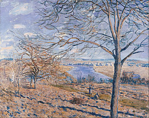 Alfred Sisley : Rives du Loing, effets d'automne (1881)
 -
 Alfred Sisley: Pont de Moret l'été (1888)
 -
 Alfred Sisley: Le long du Loing près de Moret (1892)
 -
 William Lamb Picknell: Rives du Loing (between 1894 and 1897)
 -
 Eugène Cicéri : Au bord du Loing
 -
 Eugène Galien-Laloue: Lavandières au bord du Loing


Gallery
change-
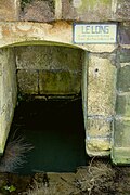 The source of the Loing in Sainte-Colombe-sur-Loing.
 -
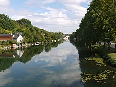 The Loing in Nemours.
 -
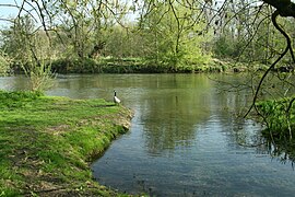
 The Loing in Grez-sur-Loing.
 -
 The Loing in Episy.
 -
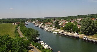 The Loing in Saint-Mammès.


Related pages
changeReferences
change- ↑ 1.0 1.1 1.2 "le Loing (F4--0200)" (in French). SANDRE - Portail national d'accès aux référentiels sur l'eau. Archived from the original on 22 May 2012. Retrieved 14 August 2017.
- ↑ "Le Loing à Épisy" (in French). Banque Hydro. Archived from the original on 3 August 2016. Retrieved 14 August 2017.
- ↑ "Source du Loing" (in French). Géoportail. Retrieved 14 August 2017.
- ↑ "Confluence du Loing" (in French). Géoportail. Retrieved 14 August 2017.