Misquah Hills
mountain range in the American state of Minnesota
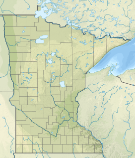
The Misquah Hills are a range of large hills or small mountains in northeastern Minnesota, in the United States. They are located in or near the Boundary Waters Canoe Area Wilderness within Superior National Forest. They contain Eagle Mountain, the highest point in Minnesota at 2,301 feet (701 meters).
| Misquah Hills | |
|---|---|
 Misquah Hills from the summit of Lima Mountain | |
| Highest point | |
| Peak | Eagle Mountain |
| Elevation | 2,301 ft (701 m) |
| Naming | |
| Etymology | "Misquah" (or miskwaa) is the Ojibwe word for "red".[1] |
| Geography | |
| Country | United States |
| State | Minnesota |
| County | Cook |
| Range coordinates | 47°59′N 90°34′W / 47.98°N 90.56°W |
| Geology | |
| Age of rock | Stenian, Proterozoic era |
| Type of rock | Duluth Complex (Granophyre) |
| Managed by the Minnesota Department of Natural Resources | |
References
change- ↑ "miskwaa (vii)". The Ojibwe People's Dictionary. Department of American Indian Studies, University of Minnesota. Retrieved 22 September 2015.
