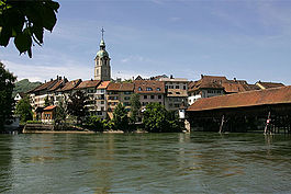
Olten
municipality of Switzerland
Olten is a city in the district Olten in the canton of Solothurn in Switzerland.
Olten | |
|---|---|
 | |
| Coordinates: 47°21′N 7°54′E / 47.350°N 7.900°E | |
| Country | Switzerland |
| Canton | Solothurn |
| District | Olten |
| Government | |
| • Mayor | Ernst Zingg |
| Area | |
| • Total | 11.5 km2 (4.4 sq mi) |
| Elevation | 396 m (1,299 ft) |
| Population (31 December 2018)[2] | |
| • Total | 18,362 |
| • Density | 1,600/km2 (4,100/sq mi) |
| Time zone | UTC+01:00 (Central European Time) |
| • Summer (DST) | UTC+02:00 (Central European Summer Time) |
| Postal code(s) | 4600 |
| SFOS number | 2581 |
| Surrounded by | Aarburg (AG), Boningen, Dulliken, Kappel, Rothrist (AG), Starrkirch-Wil, Trimbach, Wangen bei Olten, Winznau |
| Twin towns | Altenburg (Germany) |
| Website | www SFSO statistics |
Demographics
changeOlten has a population of 19209 people as of December 2019. Of this, 31.4% are foreigners.
Transport
changeTrain
changeOlten is a main SBB hub. The SBB Cargo Hub is located near the station of Olten. The Olten railway station has lines connecting outside of Switzerland. They come from Germany, and Italy.
Bus
changeThe Bus Betrieb Olten Gösgen Gäu (BOGG) currently operates in Olten.
Air
changeOlten has a grass paved airport. It is only used for leisure. Gliders usually take off there, but sometimes small planes also take off there.
References
change- ↑ 1.0 1.1 "Arealstatistik Standard - Gemeinden nach 4 Hauptbereichen". Federal Statistical Office. Retrieved 13 January 2019.
- ↑ "Ständige Wohnbevölkerung nach Staatsangehörigkeitskategorie Geschlecht und Gemeinde; Provisorische Jahresergebnisse; 2018". Federal Statistical Office. 9 April 2019. Retrieved 11 April 2019.
Other websites
changeMedia related to Olten at Wikimedia Commons


