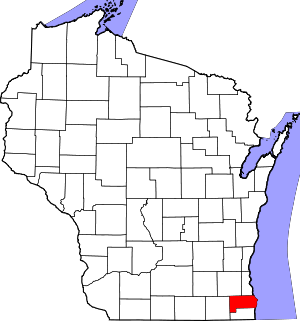
Racine County, Wisconsin
county in Wisconsin, United States
Racine County (rus-EEN, sometimes also ray-SEEN) is a county in southeastern Wisconsin. Its county seat is Racine.[2] When the 2020 census was held, Racine County had 197,727 people,[1] or the fifth-most people of any county in Wisconsin. Racine County was founded in 1836, when Wisconsin was known as theWisconsin Territory.
Racine County | |
|---|---|
 | |
 Location within the U.S. state of Wisconsin | |
 Wisconsin's location within the U.S. | |
| Coordinates: 42°47′N 87°46′W / 42.78°N 87.76°W | |
| Country | |
| State | |
| Founded | December 7, 1836 |
| Seat | Racine |
| Largest city | Racine |
| Area | |
| • Total | 792 sq mi (2,050 km2) |
| • Land | 333 sq mi (860 km2) |
| • Water | 460 sq mi (1,200 km2) 58% |
| Population | |
| • Total | 197,727 |
| • Density | 594.4/sq mi (229.5/km2) |
| Time zone | UTC−6 (Central) |
| • Summer (DST) | UTC−5 (CDT) |
| Congressional district | 1st |
| Website | www |
Racine County makes up the Racine metropolitan statistical area, the communities around Racine. This area is part of the Milwaukee-Racine-Waukesha combined statistical area.[3] According to the U.S. Census Bureau, Racine County contains 792 square miles (2,050 km2): 333 square miles (860 km2) are land and 460 square miles (1,200 km2) (58%) are water.[4] In June 2021, 5.6% of people in the county did not have a job.[5]
References
change- ↑ 1.0 1.1 "2020 Decennial Census: Racine County, Wisconsin". data.census.gov. U.S. Census Bureau. Retrieved 2 July 2022.
- ↑ "Find a County". National Association of Counties. Retrieved June 7, 2011.
- ↑ US Department of Commerce Economic & Statistics Administration; US Census Bureau (January 2012). "Milwaukee-Racine-Waukesha, WI Combined Statistical Area" (PDF). Census.gov. Archived (PDF) from the original on 2022-10-09. Retrieved July 8, 2021.
- ↑ "2010 Census Gazetteer Files". United States Census Bureau. August 22, 2012. Retrieved August 8, 2015.
- ↑ "Unemployment in the United States". Local Area Unemployment Statistics Map. Retrieved August 8, 2021.
