Template:Infobox airport/testcases

Test case 1: Public airport

change

Dallas-Fort Worth International Airport

Side by side comparison
{{Infobox airport}}{{Infobox airport/sandbox}}
Dallas-Fort Worth International Airport
Summary
Airport typePublic
OwnerCity of Dallas City of Fort Worth
OperatorDFW Airport Board
ServesDallas/Fort Worth
Elevation AMSL607 ft / 185 m
Coordinates32°53′49″N 097°02′17″W / 32.89694°N 97.03806°W / 32.89694; -97.03806
Websitewww.dfwairport.com
Map
Dallas-Fort Worth International Airport is located in Texas
Dallas-Fort Worth International Airport
Location within Texas
Runways
Direction Length Surface
ft m
13L/31R 9,000 2,743 Concrete
13R/31L 9,301 2,835 Concrete
17C/35C 13,401 4,085 Concrete
17L/35R 8,500 2,591 Concrete
17R/35L 13,401 4,085 Concrete
18L/36R 13,400 4,084 Concrete
18R/36L 13,400 4,084 Concrete
Helipads
Number Length Surface
ft m
H1 158 48 Concrete
Statistics (2005)
Passengers59,176,265
Aircraft operations711,878
Metric tonnes of cargo741,432
Sources: airport website[1] and FAA[2]
Dallas-Fort Worth International Airport
Summary
Airport typePublic
OwnerCity of Dallas City of Fort Worth
OperatorDFW Airport Board
ServesDallas/Fort Worth
Elevation AMSL607 ft / 185 m
Coordinates32°53′49″N 097°02′17″W / 32.89694°N 97.03806°W / 32.89694; -97.03806
Websitewww.dfwairport.com
Map
Dallas-Fort Worth International Airport is located in Texas
Dallas-Fort Worth International Airport
Location within Texas
Runways
Direction Length Surface
ft m
13L/31R 9,000 2,743 Concrete
13R/31L 9,301 2,835 Concrete
17C/35C 13,401 4,085 Concrete
17L/35R 8,500 2,591 Concrete
17R/35L 13,401 4,085 Concrete
18L/36R 13,400 4,084 Concrete
18R/36L 13,400 4,084 Concrete
Helipads
Number Length Surface
ft m
H1 158 48 Concrete
Statistics (2005)
Passengers59,176,265
Aircraft operations711,878
Metric tonnes of cargo741,432
Sources: airport website[1] and FAA[2]

Test case 2: Military airport

change

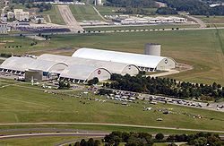
Wright-Patterson Air Force Base

Side by side comparison
{{Infobox airport}}{{Infobox airport/sandbox}}
Wright-Patterson Air Force Base


Summary
Airport typeMilitary: Air Force Base
OperatorUnited States Air Force
LocationDayton, Ohio
In use1948 - present
Commander
Elevation AMSL823 ft / 251 m
Coordinates39°49′34″N 084°02′54″W / 39.82611°N 84.04833°W / 39.82611; -84.04833
Websitewww.wpafb.af.mil
Map
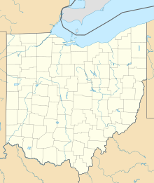
Wright-Patterson Air Force Base is located in Ohio
Wright-Patterson Air Force Base
Location within Ohio
Runways
Direction Length Surface
ft m
5L/23R 12,601 3,841 PEM
5R/23L 7,000 2,134 Asphalt
Sources: official website[3] and FAA[4]
Wright-Patterson Air Force Base

Air Force Materiel Command
Summary
Airport typeMilitary: Air Force Base
OperatorUnited States Air Force
LocationDayton, Ohio
In use1948 - present
Commander
Elevation AMSL823 ft / 251 m
Coordinates39°49′34″N 084°02′54″W / 39.82611°N 84.04833°W / 39.82611; -84.04833
Websitewww.wpafb.af.mil
Map
Wright-Patterson Air Force Base is located in Ohio
Wright-Patterson Air Force Base
Location within Ohio
Runways
Direction Length Surface
ft m
5L/23R 12,601 3,841 PEM
5R/23L 7,000 2,134 Asphalt
Sources: official website[3] and FAA[4]

Test case 3: New parameters: pushpin_mark, pushpin_marksize

change

Christmas Island Airport

Side by side comparison
{{Infobox airport}}{{Infobox airport/sandbox}}
Christmas Island Airport
Summary
Airport typePublic
OperatorPDL Toll
LocationChristmas Island
Elevation AMSL916 ft / 279 m
Coordinates10°27.0′S 105°41.4′E / 10.4500°S 105.6900°E / -10.4500; 105.6900
Map
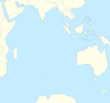
YPXM is located in Indian Ocean
YPXM
YPXM
Location on a map of the Indian Ocean
Runways
Direction Length Surface
m ft
18/36 2,103 6,900 Asphalt
Sources: Australian AIP[5]

Test case 4: Number autoformat and autoconvert ft → m

change

Dallas-Fort Worth International Airport

Side by side comparison
{{Infobox airport}}{{Infobox airport/sandbox}}
Dallas-Fort Worth International Airport
Summary
Airport typePublic
OwnerCity of Dallas City of Fort Worth
OperatorDFW Airport Board
ServesDallas/Fort Worth
Elevation AMSL607 ft / 185 m
Coordinates32°53′49″N 097°02′17″W / 32.89694°N 97.03806°W / 32.89694; -97.03806
Websitewww.dfwairport.com
Map
Dallas-Fort Worth International Airport is located in Texas
Dallas-Fort Worth International Airport
Location within Texas
Runways
Direction Length Surface
ft m
13L/31R 9,000 2,743 Concrete
13R/31L 9,301 2,835 Concrete
17C/35C 13,401 4,085 Concrete
17L/35R 8,500 2,591 Concrete
17R/35L 13,401 4,085 Concrete
18L/36R 13,400 4,084 Concrete
18R/36L 13,400 4,084 Concrete
Helipads
Number Length Surface
ft m
H1 158 48 Concrete
Statistics (2005)
Passengers59176265
Aircraft operations711878
Metric tonnes of cargo741432
Sources: airport website[6] and FAA[7]
Dallas-Fort Worth International Airport
Summary
Airport typePublic
OwnerCity of Dallas City of Fort Worth
OperatorDFW Airport Board
ServesDallas/Fort Worth
Elevation AMSL607 ft / 185 m
Coordinates32°53′49″N 097°02′17″W / 32.89694°N 97.03806°W / 32.89694; -97.03806
Websitewww.dfwairport.com
Map
Dallas-Fort Worth International Airport is located in Texas
Dallas-Fort Worth International Airport
Location within Texas
Runways
Direction Length Surface
ft m
13L/31R 9,000 2,743 Concrete
13R/31L 9,301 2,835 Concrete
17C/35C 13,401 4,085 Concrete
17L/35R 8,500 2,591 Concrete
17R/35L 13,401 4,085 Concrete
18L/36R 13,400 4,084 Concrete
18R/36L 13,400 4,084 Concrete
Helipads
Number Length Surface
ft m
H1 158 48 Concrete
Statistics (2005)
Passengers59,176,265
Aircraft operations711,878
Metric tonnes of cargo741,432
Sources: airport website[6] and FAA[7]

Test case 5: Number autoformat and autoconvert m → ft

change

Helsinki Airport

Side by side comparison
{{Infobox airport}}{{Infobox airport/sandbox}}
Helsinki Airport

Helsinki-Vantaan lentoasema
Helsingfors-Vanda flygplats
Summary
Airport typePublic
OperatorFinavia
ServesHelsinki
LocationVantaa, Finland
Hub for
Elevation AMSL55 m / 180 ft
Coordinates60°19′02″N 024°57′48″E / 60.31722°N 24.96333°E / 60.31722; 24.96333
Websitewww.helsinki-vantaa.fi
Map
HEL is located in Finland
HEL
HEL
Location within Finland
Runways
Direction Length Surface
m ft
04R/22L 3,440 11,286 Asphalt
04L/22R 3,060 10,039 Asphalt
15/33 2,901 9,518 Asphalt
Statistics (2010)
Passengers12884500
Landings88480
Source: AIP Finland[8]
Statistics from Finavia[9]
Helsinki Airport
Helsinki-Vantaan lentoasema
Helsingfors-Vanda flygplats
Summary
Airport typePublic
OperatorFinavia
ServesHelsinki
LocationVantaa, Finland
Hub for
Elevation AMSL55 m / 180 ft
Coordinates60°19′02″N 024°57′48″E / 60.31722°N 24.96333°E / 60.31722; 24.96333
Websitewww.helsinki-vantaa.fi
Map
HEL is located in Finland
HEL
HEL
Location within Finland
Runways
Direction Length Surface
m ft
04R/22L 3,440 11,286 Asphalt
04L/22R 3,060 10,039 Asphalt
15/33 2,901 9,518 Asphalt
Statistics (2010)
Passengers12,884,500
Landings88,480
Source: AIP Finland[8]
Statistics from Finavia[9]

Test case 13: Public heliport (no runways)

change

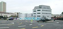
London Heliport

Side by side comparison
{{Infobox airport}}{{Infobox airport/sandbox}}
London Heliport
Summary
Airport typePublic
OwnerReuben Brothers
OperatorThe London Airport Ltd.
LocationLondon
Elevation AMSL18 ft / 5 m
Coordinates51°28′12″N 000°10′46″W / 51.47000°N 0.17944°W / 51.47000; -0.17944
Websitewww.londonheliport.co.uk
Map
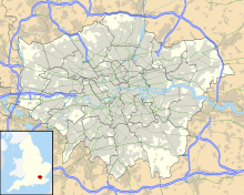
EGLW is located in Greater London
EGLW
EGLW
Location in Greater London
Helipads
Number Length Surface
m ft
03/21 38 × 16 125 × 52 Concrete
Sources: UK AIP at NATS

Test case references

change
  1. Dallas-Fort Worth International Airport, official web site
  2. FAA Airport Master Record for DFW (Form 5010 PDF)
  3. Wright-Patterson Air Force Base (official site)
  4. FAA Airport Master Record for FFO (Form 5010 PDF)
  5. YPXM – CHRISTMAS ISLAND (PDF). AIP En Route Supplement from Airservices Australia, effective 08 November 2018
  6. Dallas-Fort Worth International Airport, official web site
  7. FAA Airport Master Record for DFW (Form 5010 PDF)
  8. "EFHK Helsinki-Vantaa" (PDF). AIP Suomi / Finland. Finavia. 17 December 2009. pp. EFHK AD 2.1, pp. 1–7. Retrieved 19 February 2010.
  9. "Finavia's Air Traffic Statistics 2010" (PDF). Vantaa: Finavia. pp. 7, 9. Retrieved 15 July 2011.