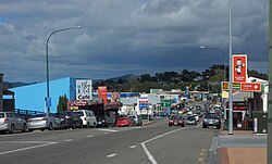
Wellsford
locality in Auckland Region, New Zealand
Wellsford (Māori: Whakapirau) is a town on the Northland Peninsula in northern New Zealand. It is a major town located 77 kilometers north of Auckland and situated on State Highway 1 and State Highway 16. It has six primary schools and one high school situated within the area. Its private school closed at the end of 2018 due to falling numbers.
Wellsford
Whakapirau (Māori) | |
|---|---|
 Main St in Wellsford | |
 | |
| Coordinates: 36°17′45″S 174°31′24″E / 36.29583°S 174.52333°E | |
| Country | New Zealand |
| Region | Auckland |
| Ward | Rodney ward |
| Community board | Rodney Local Board |
| Electorates | |
| Government | |
| • Territorial Authority | Auckland Council |
| Area | |
| • Total | 4.55 km2 (1.76 sq mi) |
| Population (June 2023)[2] | |
| • Total | 2,280 |
| • Density | 500/km2 (1,300/sq mi) |
| Postcode(s) | 0900, 0977, 0975, 0972, 0974, 0973 |
References
change- ↑ "ArcGIS Web Application". statsnz.maps.arcgis.com. Retrieved 13 May 2022.
- ↑ "Subnational population estimates (RC, SA2), by age and sex, at 30 June 1996-2023 (2023 boundaries)". Statistics New Zealand. Retrieved 25 October 2023. (regional councils); "Subnational population estimates (TA, SA2), by age and sex, at 30 June 1996-2023 (2023 boundaries)". Statistics New Zealand. Retrieved 25 October 2023. (territorial authorities); "Subnational population estimates (urban rural), by age and sex, at 30 June 1996-2023 (2023 boundaries)". Statistics New Zealand. Retrieved 25 October 2023. (urban areas)