Wittenberg (district)
German district in Saxony-Anhalt
(Redirected from Wittenberg Rural District)
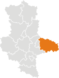
Wittenberg is a district (Kreis) in the east of Saxony-Anhalt, Germany.
Wittenberg | |
|---|---|
 | |
| Coordinates: 51°48′N 12°41′E / 51.800°N 12.683°E | |
| Country | Germany |
| State | Saxony-Anhalt |
| Capital | Wittenberg |
| Area | |
| • Total | 1,929.89 km2 (745.13 sq mi) |
| Population (31 December 2021)[1] | |
| • Total | 123,341 |
| • Density | 64/km2 (170/sq mi) |
| Time zone | UTC+01:00 (CET) |
| • Summer (DST) | UTC+02:00 (CEST) |
| Vehicle registration | WB |
| Website | landkreis-wittenberg.de |
History
changeIn 1994 the district was merged with the district of Jessen and a small part of the district of Gräfenhainichen. In 2007, 27 municipalities from the former district Anhalt-Zerbst were added to the district of Wittenberg.
Coat of arms
change| The coat of arms show two swords, which is the symbol of a field marshal in the Holy Roman Empire. This title was held by the counts of Saxony, who therefore added the symbol to their coat of arms. The centre of the principality of Saxony was in the district. |
Towns and municipalities
changePopulation figures are as at 30 June 2005.
| Free towns |
|---|
|
After the resolution of 6 October 2005, as part of municipal reform, the 27 towns and communities of the Verwaltungsgemeinschaften of Coswig and Wörlitzer Winkel, formerly in the Anhalt-Zerbst district, were assigned to Wittenberg district on 1 July 2007.
References
change- ↑ "Bevölkerung der Gemeinden – Stand: 31. Dezember 2021" (PDF) (in German). Statistisches Landesamt Sachsen-Anhalt. June 2022.
Other websites
change- Official website (in German)
