Castle Dale, Utah
city in Emery County, Utah, United States
Castle Dale is a city in and the county seat of Emery County, Utah, United States. As of the 2020 census, 1,492 people live in Castle Dale.[4]
Castle Dale, Utah | |
|---|---|
 Castle Dale's city hall | |
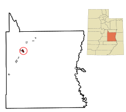
 Location within Emery County and the State of Utah | |
 Location of Utah in the United States | |
| Coordinates: 39°12′57″N 111°1′15″W / 39.21583°N 111.02083°W | |
| Country | United States |
| State | Utah |
| County | Emery |
| Settled | 1877 |
| Incorporated | 1920 |
| Area | |
| • Total | 2.23 sq mi (5.79 km2) |
| • Land | 2.23 sq mi (5.79 km2) |
| • Water | 0.00 sq mi (0.00 km2) |
| Elevation | 5,676 ft (1,730 m) |
| Population (2020) | |
| • Total | 1,492 |
| • Density | 670/sq mi (260/km2) |
| Time zone | UTC-7 (Mountain (MST)) |
| • Summer (DST) | UTC-6 (MDT) |
| ZIP code | 84513 |
| Area code | 435 |
| FIPS code | 49-10660[2] |
| GNIS feature ID | 1426380[3] |
| Website | www |
References
change- ↑ "2019 U.S. Gazetteer Files". United States Census Bureau. Retrieved August 7, 2020.
- ↑ "U.S. Census website". United States Census Bureau. Retrieved January 31, 2008.
- ↑ "US Board on Geographic Names". United States Geological Survey. October 25, 2007. Retrieved January 31, 2008.
- ↑ "Castle Dale city, Utah". United States Census Bureau. Retrieved July 27, 2023.