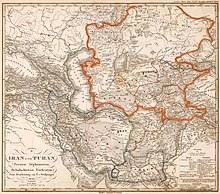
Turan Depression
The Turan Depression, Turan Lowland or Turanian Basin is a low-lying desert basin region stretching from southern Turkmenistan through Uzbekistan to Kazakhstan.[1] The lowland region lies to the east of the Caspian Sea and southeast of the Aral Sea in the vast Aral–Caspian Depression. Some of it is above sea level. It is one of the largest expanses of sand in the world,[2] covering an area of around 3 million km2. On average, the region receives less than 15 inches (381mm) of rainfall per year. The Karakum desert lies at the southern portion of the Turan Lowlands.

About 80% of it is desert or desert-like. In the south there are rivers, and oases. Cotton and different kinds of wheat are grown there. In the desert-like areas, there are only small bushes, and camels and goats live there. There are a number of rivers. The most important of these are the Amu Darya and the Syr Darya. Both flow into Aral Sea. The Amu Darya River runs in a southeast–north-westerly direction through the lowlands.[3] It used to flow into the South Aral Sea, currently it dries up in a desert called Aralkum. Syr Darya flows into North Aral Sea.
The three most important cities are Daşoguz in Turkmenistan, and Nukus and Urgench in Uzbekistan. Vpadina Akchanaya in Turkmenistan is 267 feet (81 meters) below sea level.
References
change- ↑ Métailie, Georges; Da Lage, Antoine, eds. (5 March 2015). Dictionnaire de biogéographie végétale [Dictionary of plant biogeography] (in French) (Nouvelle ed.). CNRS EDITIONS. ISBN 978-2271083289.
- ↑ Caroe, Olaf (1953). "The Turanian Basin". Soviet Empire: The Turks of Central Asia and Stalinism. Macmillan. OCLC 862273470.
- ↑ "Turán". Gran Enciclopedia Ilustrada (in Spanish). Vol. 19. Ediciones Danae, S.A. ISBN 84-7505-292-4.