Vila Real
municipality and city in Portugal
Vila Real (Portuguese pronunciation: [ˈvilɐ ʁiˈal] (![]() listen)) is the capital of the Vila Real District. It is also largest city in the district. The city is in the North region of Portugal. The Vila Real has an area of 378.80 km2 (146.26 sq mi).[1] In 2021, 49,571 people lived there.[2]
listen)) is the capital of the Vila Real District. It is also largest city in the district. The city is in the North region of Portugal. The Vila Real has an area of 378.80 km2 (146.26 sq mi).[1] In 2021, 49,571 people lived there.[2]
Vila Real | |
|---|---|
|
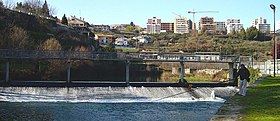
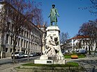
From top left to right: Corgo River near Codessais, Carvalho Araújo Statue, Mateus Palace, St. Peter's Chruch, Quintela Tower and St. Paul's Church (Capela Nova). | |
 | |
| Coordinates: 41°17′45″N 07°44′46″W / 41.29583°N 7.74611°W | |
| Country | |
| Region | Norte |
| Intermunic. comm. | Douro |
| District | Vila Real |
| Established | 1289 (city: 1925) |
| Government | |
| • President | Rui Santos (PS) |
| Area | |
| • Total | 378.80 km2 (146.26 sq mi) |
| Elevation | 450 m (1,480 ft) |
| Population (2021) | |
| • Total | 49,571 |
| • Density | 130/km2 (340/sq mi) |
| Time zone | UTC±00:00 (WET) |
| • Summer (DST) | UTC+01:00 (WEST) |
| Postal code | 5000 |
| Area code | 259 |
| Website | https://www.cm-vilareal.pt/ |
References
change- ↑ "Áreas das freguesias, concelhos, distritos e país". Archived from the original on 2018-11-05. Retrieved 2018-11-05.
- ↑ INE (2022-11-23). "Population and Housing Census - 2021 Census". tabulador.ine.pt. Retrieved 2023-01-22.


