Vlissingen
municipality in Zeeland, the Netherlands
Vlissingen, Zeelandic: Vlissienge, English: Flushing, is a city, municipality and seaport in the province of Zeeland, the Netherlands.
Vlissingen
Flushing | |
|---|---|
 Clockwise from top left: Coastline skyscraper, harbour, museum, residential tower and boulevard with beach | |
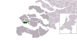
 Location in Zeeland | |
| Coordinates: 51°27′N 3°34′E / 51.450°N 3.567°E | |
| Country | Netherlands |
| Province | Zeeland |
| Boroughs | 8 Districts
|
| Government | |
| • Body | Municipal council |
| • Mayor | Letty Demmers-van der Geest (D66) |
| Area | |
| • Total | 344.84 km2 (133.14 sq mi) |
| • Land | 34.31 km2 (13.25 sq mi) |
| • Water | 310.53 km2 (119.90 sq mi) |
| Elevation | 1 m (3 ft) |
| Population (January 2019)[4] | |
| • Total | 44,371 |
| • Density | 1,293/km2 (3,350/sq mi) |
| Demonym | Vlissinger |
| Time zone | UTC+1 (CET) |
| • Summer (DST) | UTC+2 (CEST) |
| Postcode | 4380–4389 |
| Area code | 0118 |
| Website | www |
The city has about 33,000 people. The municipality has about 44,000 (2016). It has been an important harbor for centuries. Most of the Royal Netherlands Navy ships are built in Vlissingen.
References
change- ↑ "Burgemeester Letty Demmers-van der Geest" [Mayor Letty Demmers-van der Geest] (in Dutch). Gemeente Vlissingen. Archived from the original on 24 December 2013. Retrieved 22 December 2013.
- ↑ "Kerncijfers wijken en buurten 2020" [Key figures for neighbourhoods 2020]. StatLine (in Dutch). CBS. 24 July 2020. Retrieved 19 September 2020.
- ↑ "Postcodetool for 4382MA". Actueel Hoogtebestand Nederland (in Dutch). Het Waterschapshuis. Archived from the original on 21 September 2013. Retrieved 22 December 2013.
- ↑ "Bevolkingsontwikkeling; regio per maand" [Population growth; regions per month]. CBS Statline (in Dutch). CBS. 1 January 2019. Retrieved 1 January 2019.
Other websites
change- Media related to Vlissingen at Wikimedia Commons
- Vlissingen travel guide from Wikivoyage

