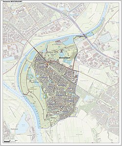
Westervoort
municipality in Gelderland, the Netherlands
Westervoort is a municipality and town in the province of Gelderland, the Netherlands. About 15,000 people were living there in 2021.
Westervoort | |
|---|---|
Municipality, town | |
 Street through Westervoort | |
 Location | |
 Map | |
| Coordinates: 51°58′N 5°58′E / 51.967°N 5.967°E | |
| Country | |
| Province | |
| Region | IJsselvallei, Liemers |
| Government | |
| • Body | Municipal council |
| • Mayor | Arend van Hout (VVD) |
| Area | |
| • Total | 7.84 km2 (3.03 sq mi) |
| • Land | 7.03 km2 (2.71 sq mi) |
| • Water | 0.81 km2 (0.31 sq mi) |
| Elevation | 11 m (36 ft) |
| Population (2019)[4] | |
| • Total | 14,944 |
| • Density | 2,126/km2 (5,510/sq mi) |
| Time zone | UTC+1 (CET) |
| • Summer (DST) | UTC+2 (CEST) |
| Postcode | 6931–6932 |
| Area code | 026 |
| Website | www |
It lies both in the IJsselvallei and Liemers regions, at the meeting point of the Rhine and IJssel rivers.
References
change- Plaatsengids.nl Archived 2022-06-27 at the Wayback Machine
- ↑ "Samenstelling college van B&W". Gemeente Westervoort (in Dutch). Retrieved 14 February 2022.
- ↑ "Kerncijfers wijken en buurten 2020" [Key figures for neighbourhoods 2020]. StatLine (in Dutch). CBS. 24 July 2020. Retrieved 19 September 2020.
- ↑ "Postcodetool". Actueel Hoogtebestand Nederland (in Dutch). Archived from the original on 27 July 2014. Retrieved 14 February 2022.
- ↑ "Bevolkingsontwikkeling; regio per maand" [Population growth; regions per month]. CBS Statline (in Dutch). CBS. 1 January 2019. Retrieved 1 January 2019.

