Alamogordo, New Mexico
city in Otero County, New Mexico, United States
Alamogordo /ˌæləməˈɡɔːrdoʊ/ is the seat of Otero County, New Mexico, United States. The population was 30,898 as of the 2020 census.[5]
Alamogordo, New Mexico | |
|---|---|
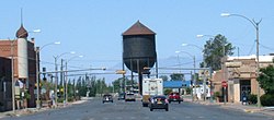
Downtown Alamogordo, looking west on 10th Street; Jim Griggs Sports Complex; Shops on New York Avenue; Water Tower looking east on Tenth Street; Kids' Kingdom Park; View of Alamogordo from Thunder Road | |
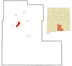
 Location in New Mexico | |
| Coordinates: 32°51′22″N 105°58′28″W / 32.85611°N 105.97444°W[3] | |
| Country | United States |
| State | New Mexico |
| County | Otero[1][2] |
| Founded | 1898 |
| Incorporated | 1912 |
| Named for | álamo gordo, Spanish for "fat cottonwood" |
| Government | |
| • Type | Commission–manager |
| Area | |
| • Total | 21.58 sq mi (55.90 km2) |
| • Land | 21.57 sq mi (55.87 km2) |
| • Water | 0.01 sq mi (0.03 km2) |
| Elevation | 4,330 ft (1,320 m) |
| Population | |
| • Total | 30,898 |
| • Density | 1,444.5/sq mi (557.7/km2) |
| Time zone | UTC−7 (Mountain Standard Time Zone) |
| • Summer (DST) | UTC−6 (Mountain Daylight Time) |
| ZIP codes[6] | 88310, 88311 (PO Box) |
| Area code | 575 |
| FIPS code | 35-01780 |
| GNIS feature ID | 2409672[3] |
| Website | ci |
References
change- ↑ "US Board on Geographic Names". United States Geological Survey. 2007-10-25. Retrieved 2008-01-31.
- ↑ "Find a County". National Association of Counties. Archived from the original on May 31, 2011. Retrieved 2011-06-07.
- ↑ 3.0 3.1 3.2 U.S. Geological Survey Geographic Names Information System: Alamogordo, New Mexico
- ↑ "ArcGIS REST Services Directory". United States Census Bureau. Retrieved October 12, 2022.
- ↑ 5.0 5.1 "QuickFacts: Alamogordo city, New Mexico". United States Census Bureau. Retrieved March 14, 2024.
- ↑ "ZIP Code Lookup". United States Postal Service. Archived from the original (JavaScript/HTML) on January 1, 2008. Retrieved January 1, 2008.


