Baxter Springs, Kansas
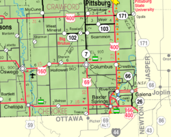
Baxter Springs is a city in Cherokee County, Kansas, United States. It is along the Spring River. In 2020, 3,888 people lived there.[3] It is the biggest city in Cherokee County.
Baxter Springs, Kansas | |
|---|---|
 Downtown Baxter Springs (2008) | |
 Location within Cherokee County and Kansas | |
 | |
| Coordinates: 37°01′10″N 94°44′06″W / 37.01944°N 94.73500°W[1] | |
| Country | United States |
| State | Kansas |
| County | Cherokee |
| Founded | 1858 |
| Incorporated | 1868 |
| Named for | A. Baxter |
| Area | |
| • Total | 3.24 sq mi (8.38 km2) |
| • Land | 3.15 sq mi (8.16 km2) |
| • Water | 0.09 sq mi (0.23 km2) |
| Elevation | 843 ft (257 m) |
| Population | |
| • Total | 3,888 |
| • Density | 1,200/sq mi (460/km2) |
| Time zone | UTC-6 (CST) |
| • Summer (DST) | UTC-5 (CDT) |
| ZIP code | 66713 |
| Area code | 620 |
| FIPS code | 20-04625 |
| GNIS ID | 485544[1] |
| Website | City webpage |
History
changeOne of the largest Osage bands was led by Chief Black Dog (Manka - Chonka). His men finished what became known as the Black Dog Trail by 1803.[4][5] It started from their winter territory. This territory was east of Baxter Springs, and it went southwest to their summer hunting area at the Great Salt Plains in present-day Alfalfa County, Oklahoma.[5][6][7] The Osage regularly stopped at the springs for healing on their way to summer hunting area. They made the trail by clearing it of brush and big rocks. They built ramps from the ground to the fords. The trail was the first improved road in Kansas and Oklahoma. It was big enough for eight horsemen to be riding side-by-side.[8]
Geography
changeBaxter Springs is at 37°1′23″N 94°44′5″W / 37.02306°N 94.73472°W (37.023062, -94.734762).[9]
The United States Census Bureau says that the city has a total area of 3.24 square miles (8.39 km2). Of that, 3.15 square miles (8.16 km2) is land and 0.09 square miles (0.23 km2) is water.[2]
People
change| Historical population | |||
|---|---|---|---|
| Census | Pop. | %± | |
| 1870 | 1,284 | — | |
| 1880 | 1,177 | −8.3% | |
| 1890 | 1,248 | 6.0% | |
| 1900 | 1,641 | 31.5% | |
| 1910 | 1,598 | −2.6% | |
| 1920 | 3,608 | 125.8% | |
| 1930 | 4,541 | 25.9% | |
| 1940 | 4,921 | 8.4% | |
| 1950 | 4,647 | −5.6% | |
| 1960 | 4,498 | −3.2% | |
| 1970 | 4,489 | −0.2% | |
| 1980 | 4,773 | 6.3% | |
| 1990 | 4,351 | −8.8% | |
| 2000 | 4,602 | 5.8% | |
| 2010 | 4,238 | −7.9% | |
| 2020 | 3,888 | −8.3% | |
| U.S. Decennial Census | |||
2020 census
changeThe census of 2020 says that there were 3,888 people, 1,595 households, and 979 families living in Baxter Springs. Of the households, 63.9% owned their home and 36.1% rented their home.
The median age was 38.8 years. Of the people, 78.9% were White, 7.1% were Native American, 0.6% were Asian, 0.5% were Pacific Islanders, 0.4% were Black, 1.1% were from some other race, and 11.5% were two or more races. Hispanic or Latino of any race were 3.1% of the people.[3][10]
2010 census
changeThe census of 2010 says that there were 4,238 people, 1,754 households, and 1,151 families living in Baxter Springs.[11]
References
change- ↑ 1.0 1.1 1.2 U.S. Geological Survey Geographic Names Information System: Baxter Springs, Kansas
- ↑ 2.0 2.1 "2020 U.S. Gazetteer Files". United States Census Bureau. Retrieved November 20, 2023.
- ↑ 3.0 3.1 3.2 "DP1: PROFILE OF GENERAL POPULATION AND HOUSING CHARACTERISTICS". United States Census Bureau. Retrieved November 20, 2023.
- ↑ "Black Dog Trail Marker". Archived from the original on 2017-11-07. Retrieved 2012-01-14.
- ↑ 5.0 5.1 Burl E. Self, "Black Dog" Archived 2010-02-09 at the Wayback Machine, Oklahoma Encyclopedia of History and Culture, accessed 5 Nov 2009
- ↑ "Full text of "Wah Kon Tah The Osage And White Man S Road"". Retrieved 2012-01-14.
- ↑ "DEXTER, "In The Flint Hills" KANSAS: BLACK DOG TRAIL.Photo of Chief Blackdog". Retrieved 2012-01-14.
- ↑ Louis F. Burns, "Osage" Archived 2011-01-02 at the Wayback Machine, Oklahoma Encyclopedia of History and Culture, accessed 5 Nov 2009
- ↑ "US Gazetteer files: 2010, 2000, and 1990". United States Census Bureau. 2011-02-12. Retrieved 2011-04-23.
- ↑ "P16: HOUSEHOLD TYPE". United States Census Bureau. Retrieved December 30, 2023.
- ↑ "American FactFinder". United States Census Bureau. Retrieved 2012-07-06.
Other websites
change- City
- City of Baxter Springs
- Baxter Springs - Directory of Public Officials
- Baxter Springs Heritage Center and Museum Archived 2019-10-26 at the Wayback Machine
- Schools
- USD 508, local school district
- Maps
- Baxter Springs City Map, KDOT