Caerleon
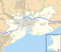
Caerleon (/kərˈliːən/; Welsh: Caerllion) is a town and community on the River Usk.[4][5] It is situated 5 miles (8 km) northeast of the city of Newport, Wales and 5.5 miles (9 km) southeast of Cwmbran. Caerleon is of archaeological importance, as it is the site of a notable Roman legionary fortress, Isca Augusta, and an Iron Age hillfort.
Caerleon
| |
|---|---|
 Caerleon from St Julians, Newport | |
| Location within Newport | |
| Area | 9.03 sq mi (23.4 km2) [1] |
| Population | 8,061 [2] |
| • Density | 893/sq mi (345/km2) [3] |
| Demonym | Caerleonite |
| Language | English Welsh |
| OS grid reference | ST336909 |
| • Cardiff | 13 mi (21 km) westwards |
| • London | 122 mi (196 km) eastwards |
| Community | |
| Principal area | |
| Ceremonial county | |
| Country | Wales |
| Sovereign state | United Kingdom |
| Post town | NEWPORT |
| Postcode district | NP18 |
| Dialling code | 01633 |
| Police | Gwent |
| Fire | South Wales |
| Ambulance | Welsh |
| UK Parliament | |
| Welsh Assembly | |
| Website | newport.gov.uk |
Transport
changeRoad
changeCaerleon is 3.5 miles (5.6 km) from Newport city centre and 5.5 miles (8.9 km) from Cwmbran. Caerleon is 2 miles (3.2 km) north of the M4 motorway. The B4596 (Caerleon Road) links Newport city centre to Caerleon via M4 Junction 25, crossing Caerleon Bridge into Caerleon High Street. The B4236 (Ponthir Road) links Caerleon to Cwmbran. The Usk Road links Caerleon to Usk.
A regular bus service links Caerleon to Newport city centre and Cwmbran. There is a City Sightseeing open-top bus service in summer months. A cycle and pedestrian walkway alongside the River Usk links Caerleon to Malpas and Newport city centre at Crindau, route 88 of the National Cycle Network.[6]
Rail
changeTrains pass through Caerleon on the Welsh Marches Line, but do not stop at the closed Caerleon railway station. The nearest passenger stations are Newport railway station, and Cwmbran railway station.
Transport for Wales have announced that Caerleon could have a station as part of the South Wales Metro project.[7]
References
change- ↑ http://www.newport.gov.uk/documents/One-Newport/Caerleon-Profile-Final-2017.pdf
- ↑ Census, 2011
- ↑ List of Welsh principal areas by population density
- ↑ "Caerleon - Newport City Council". www.newport.gov.uk. Retrieved 31 October 2017.
- ↑ "Geograph:: The River Usk, looking downstream (C) Roger Cornfoot". geograph.org.uk. Retrieved 15 December 2016.
- ↑ "'Vital' Caerleon cycle link opens". southwalesargus.co.uk. Retrieved 15 December 2016.
- ↑ "South Wales Metro summary brochure" (PDF). gov.wales. Archived from the original (PDF) on 20 February 2019. Retrieved 20 February 2019.
