Cook County, Illinois
county in Illinois, United States
Cook County is a county in the American state of Illinois. Chicago is the county seat of Cook County. Los Angeles County, California is the only county with a higher population than Cook County.[5]
Cook County, Illinois | |
|---|---|
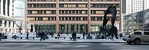
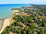
From top, left to right: Cook County Circuit Court at Daley Center with Chicago Picasso, Frank Lloyd Wright Home and Studio, Forest Preserve District, aerial view of downtown Chicago, aerial view of Evanston, Montrose Avenue Beach in Chicago | |
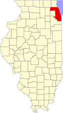 Location within Illinois | |
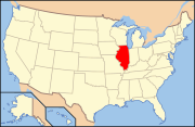 Illinois' location within the United States | |
| Coordinates: 41°48′31″N 87°53′20″W / 41.80861°N 87.88889°W | |
| Country | United States |
| State | Illinois |
| Metro area | Chicago metropolitan area |
| Incorporated | January 15, 1831 |
| Named for | Daniel Pope Cook |
| County seat | Chicago |
| Area | |
| • Total | 1,635 sq mi (4,230 km2) |
| • Land | 945 sq mi (2,450 km2) |
| • Water | 690 sq mi (1,800 km2) |
| Highest elevation | 950 ft (290 m) |
| Lowest elevation | 580 ft (180 m) |
| Population | |
| • Total | 5,275,541 |
| • Density | 3,200/sq mi (1,200/km2) |
| Time zone | UTC−6 (Central) |
| • Summer (DST) | UTC−5 (Central) |
| Area codes | 224/847, 312/872, 773/872, 708 |
| FIPS code | 17-031 |
| GNIS feature ID | 1784766 |
| Website | www.cookcountyil.gov |
About 5,276,000 people live in Cook County.[4] This is 41 percent of all the people who live in Illinois. Cook County's population is more than the population of 28 U.S. states. More people live in Cook County than in the six smallest U.S. states combined. There is a tax on canned beverages in Cook County.[6]
References change
- ↑ 1.0 1.1 "Lowest and Highest Points in Cook County". Illinois State Geological Survey. Archived from the original on December 1, 2016. Retrieved 2016-11-30.
Greater than 950 ft max and Less than 580 ft min
- ↑ Streamwood Quadrangle – Illinois – Cook Co (Map). 1:24,000. 7.5-Minute Series (Topographic). United States Geological Survey. 2013.
- ↑ Chicago Loop Quadrangle – Illinois – Cook Co (Map). 1:24,000. 7.5-Minute Series (Topographic). United States Geological Survey. 2013.
- ↑ 4.0 4.1 "QuickFacts: Cook County, Illinois". United States Census Bureau. Retrieved August 14, 2023.
- ↑ http://newsblogs.chicagotribune.com/clout_st/2008/07/cook-county-boa.html | Clout St: Cook County Board rejects sales tax increase repeal
- ↑ "County Population Estimates".
Other websites change
Media related to Cook County, Illinois at Wikimedia Commons
- Cook County History Pages Archived 2017-03-09 at the Wayback Machine
