Geography of Iran
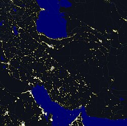
The Geography of Iran contains mountains, rivers as well as plain land. Iran is a country of Southwest Asia, it borders the Gulf of Oman, the Persian Gulf, and the Caspian Sea, between Iraq and Pakistan. Iran is one of the world's most mountainous countries.


Iran has an area of 1,648,000 square kilometres and is the sixteenth largest in size. Iran is bordered to the north by Armenia, Azerbaijan, and Turkmenistan. The border with these countries are more than 2,000 kilometres long and includes nearly 650 kilometres of water along the southern shore of the Caspian Sea.
Iran's western borders are with Turkey in the north and Iraq in the south, ending at the Shatt al Arab (which Iranians call the Arvand Rud). The Persian Gulf and Gulf of Oman littorals form the southern border (1,770 kilometres). To the east lie Afghanistan on the north and Pakistan on the south. The distance from the Iran's border with Azerbaijan in the north-west to the border with Pakistan in the south-east is about 2,333 kilometres.
Other websites
change- Iran in Maps - BBC (population, land, infrastructure)
- "Persia (Iran), Afghanistan and Baluchistan" is an old map from 1897 of Persia, also known as Iran