Laacher See
Laacher See (literally: Lake Laach; German pronunciation: [ˈlaːxɐ ˈzeː]) is a volcanic caldera lake located in Rhineland-Palatinate, Germany.[1][2]
| Laacher See Lake Laach | |
|---|---|
 View of the caldera | |
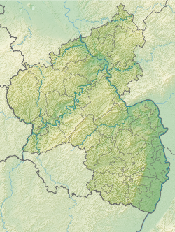
Location in Germany | |
| Location | Ahrweiler, Rhineland-Palatinate |
| Coordinates | 50°25′N 7°16′E / 50.417°N 7.267°E |
| Type | Volcanic caldera lake |
| Primary inflows | None |
| Primary outflows | Fulbert-Stollen (canal) |
| Basin countries | Germany |
| Max. length | 1.964 km (1.220 mi) |
| Max. width | 1.186 km (0.737 mi) |
| Surface area | 3.3 km2 (1.3 sq mi) |
| Average depth | 31 m (102 ft) |
| Max. depth | 51 m (167 ft) |
| Water volume | 103,000,000 m3 (3.6×10⁹ cu ft) |
| Shore length1 | 7.3 km (4.5 mi) |
| Surface elevation | 275 m (902 ft) |
| Islands | None |
| 1 Shore length is not a well-defined measure. | |


The diameter is 2 km, and it is located 24 km from Koblenz, 8 km from Andernach and the Rhine River, and 37 km from Bonn. Its last volcanic eruption, which was a Plinian eruption, was around 11,000 years B.C., with a Volcanic Explosivity Index (VEI) of 6, having the same magnitude as the Plinian eruption of Mount Pinatubo in 1991. It is part of the mountainous Eifel region, and the East Eifel Volcanic Region, which was formed after the collision of the African and Eurasian continents millions of years ago.[3][4][5] Bubbles of odorless CO2 gas called mofettas are released from the lake, which means that the volcano is dormant. To the west of the lake is the Maria Laach Abbey, built in 1092 by Henry II of Laach, Count of the House of Luxembourg.


References
change- ↑ Oppenheimer, Clive (2011). Eruptions that Shook the World. Cambridge University Press. pp. 216–217. ISBN 978-0-521-64112-8.
- ↑ de Klerk, Pim; et al. (2008). "Environmental impact of the Laacher See eruption at a large distance from the volcano: Integrated palaeoecological studies from Vorpommern (NE Germany)". Palaeogeography, Palaeoclimatology, Palaeoecology. 270 (1–2): 196–214. Bibcode:2008PPP...270..196D. doi:10.1016/j.palaeo.2008.09.013.
- ↑ Bogaard, Paul van den (1995). "40Ar/39Ar ages of sanidine phenocrysts from Laacher See Tephra (12,900 yr BP): Chronostratigraphic and petrological significance". Earth and Planetary Science Letters. 133 (1–2): 163–174. Bibcode:1995E&PSL.133..163V. doi:10.1016/0012-821X(95)00066-L.
- ↑ "Geo-Education and Geopark Implementation in the Vulkaneifel European Geopark/Vulkanland Eifel National Geopark". The Geological Society of America. 2011. Archived from the original on 2019-01-13. Retrieved 2022-03-09.
- ↑ Reinig, Frederick; Wacker, Lukas; Jöris, Olaf; Oppenheimer, Clive; Guidobaldi, Giulia; Nievergelt, Daniel; et al. (30 June 2021). "Precise date for the Laacher See eruption synchronizes the Younger Dryas". Nature. 595 (7865): 66–69. Bibcode:2021Natur.595...66R. doi:10.1038/S41586-021-03608-X. ISSN 1476-4687. Wikidata Q107389873.
[Measurements] firmly date the [Laacher See eruption] to 13,006 ± 9 calibrated years before present (BP; taken as AD 1950), which is more than a century earlier than previously accepted.
Other websites
change- Continuous event display of the 10 most recent registered seismic activities measured from the Laacher See
- Apokalypse im Rheintal (Cornelia Park und Hans-Ulrich Schmincke)
- Martin Hensch, etal.: Deep low-frequency earthquakes reveal ongoing magmatic recharge beneath Laacher See Volcano (Eifel, Germany). Geophys. J. Int. (2019) 216, 2025–2036 doi:10.1093/gji/ggy532
- Michael W. Förster, Frank Sirocko: Volcanic activity in the Eifel during the last 500,000 years: The ELSA-Tephra-Stack .Global and Planetary Change (2016) (PDF)

