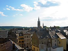
Luxembourg (Belgium)
Luxembourg [4] (French: Luxembourg, Dutch: Luxemburg, German: Luxemburg, Luxembourgish: Lëtzebuerg, Walloon: Lussimbork) is the southernmost province of Belgium and Wallonia.
Luxembourg
Luxembourg (French) | |
|---|---|
 | |
| Coordinates: 49°41′N 05°49′E / 49.683°N 5.817°E | |
| Country | |
| Region | |
| Capital | Arlon |
| Government | |
| • Governor | Olivier Schmitz |
| Area | |
| • Total | 4,459 km2 (1,722 sq mi) |
| Population (1 January 2022)[2] | |
| • Total | 291,143 |
| • Density | 65/km2 (170/sq mi) |
| HDI (2019) | 0.899[3] very high · 10th of 11 |
| Website | Official site |

The capital is Arlon, in the southeast of the province. The province is also called "Belgian Luxembourg" and should not be confused with the Grand Duchy of Luxembourg.
Geography
changeIt borders on (clockwise starting from the east) the Grand Duchy of Luxembourg, France in the south, and the Belgian provinces of Namur in the west and Liège in the north. Neither Luxembourg nor neighboring Namur border Flanders.
It has the smallest population of all the Belgian provinces, about 291,000 in 2022. With 4,459 km2 (1,722 sq mi), it is the largest province of Belgium. It is also significantly larger and significantly less populous than the neighbouring Grand Duchy of Luxembourg.
The main natural regions in the province are Belgian Lorraine in the southern part, the Ardennes in the centre and northern part, and the Famenne and Condroz in the very northwestern part of the province.
With 652 m (2,139 ft), the Baraque de Fraiture in the municipality of Vielsalm is the highest point of the province. Second is the Galata with 589 m (1,932 ft) in the municipality of Saint-Hubert.
The main rivers in the province of Luxembourg are:
- Semois, a right tributary of the Meuse river, that flows from east to west in the south of the province
- Sauer (German, Luxembourgish) or Sûre (French), a left tributary of the Moselle river, flowing to the country of Luxembourg in the east
- Lesse, another right tributary of the Meuse river, flowing to near the city of Dinant in the west
- Ourthe, another right tributary of the Meuse river, flowing to the city of Liège in the north
History
changeThe province was separated from the neighbouring Luxembourg by the Third Partition of Luxembourg in 1839, after the Belgian Revolution, and declared to remain a part of Belgium.
During World War I, Luxembourg was occupied by the German Empire.
The Battle of the Bulge, a German counter-attack against the Allied offensive in the Ardennes in the winter of 1944/45, took also place in the province of Luxembourg.
Language
changeMost of the residents of Luxembourg speak French, but there is a small Luxembourgish-speaking minority, in Arelerland (the eastern part of Belgian Lorraine: Arlon and surroundings), near the border with the Grand Duchy of Luxembourg in the southeast.
The dialect of Luxembourg (although slightly spoken) is Walloon. In the western part of Belgian Lorraine people speak Gaumais (the region is called the Gaume). Both are Romance languages.
Administrative division
changeThe province of Luxembourg is divided into 5 arrondissements and a total of 44 municipalities.
(names are in the following table)
| Arlon | Bastogne | Marche-en-Famenne |
|---|---|---|
|
|
|
| Neufchâteau | Virton | |
|
|
Population by arrondissement
changePopulation x 1,000 (on 1 January since 1980).[5]
| Arrondissement | 1970 | 1980 | 1990 | 2000 | 2010 | 2020 |
|---|---|---|---|---|---|---|
| Arlon | 48 | 49 | 49 | 52 | 58 | 63 |
| Bastogne | 35 | 36 | 37 | 41 | 45 | 49 |
| Marche-en-Famenne | 40 | 42 | 46 | 50 | 54 | 57 |
| Neufchâteau | 53 | 52 | 53 | 56 | 60 | 64 |
| Virton | 42 | 44 | 45 | 48 | 52 | 54 |
| Province of Luxembourg | 217 | 222 | 231 | 247 | 269 | 287 |
References
change- ↑ "Bodembezetting volgens het Kadasterregister". statbel.fgov.be.
- ↑ "Structuur van de bevolking". statbel.fgov.be.
- ↑ "Sub-national HDI - Area Database - Global Data Lab".
- ↑ Official name is Province de Luxembourg (French).
- ↑ Institut national de statistique - Direction générale Statistique et information économique
Other websites
change- (in French) Official site of the province Archived 2022-10-15 at the Wayback Machine
- Tourist Information in Belgian Luxembourg - Official website Archived 2013-08-11 at the Wayback Machine

