Nera (Tiber)
The Nera (Latin: Nar) is a river in central Italy that starts in the Marche region but flows mainly through the Umbria region. It is the main tributary of the Tiber river.
| Nera | |
|---|---|
 The view of Nera in Castelsantangelo sul Nera | |
.png) | |
| Location | |
| Country | Italy |
| Physical characteristics | |
| Source | |
| - location | Vallinfante |
| - elevation | 1,800 m (5,900 ft) |
| Mouth | Tiber |
| - location | near Orte |
| - coordinates | 42°26′34″N 12°24′45″E / 42.4428°N 12.4125°E |
| Length | 116 km (72 mi) |
| Basin size | 4,280 km2 (1,650 sq mi) |
| Discharge | |
| - average | 168 m3/s (5,900 cu ft/s) |
| Basin features | |
| Progression | Tiber→ Tyrrhenian Sea |
| Tributaries | |
| - left | Corno, Velino |
Geography
changeThe Nera river has a length of 116 km (72 mi), and a drainage basin with an area of approximately 4,280 km2 (1,653 sq mi).[1]
Course
changeThe Nera river starts in the Monti Sibillini, within the Monti Sibillini National Park (Italian: Parco Nazionale dei Monti Sibillini), at an elevation of about 902 m (2,959 ft).,[2] in the comune of Castelsantangelo sul Nera, Province of Macerata, Marche.
The river flows through the comuni of Castelsantangelo sul Nera, Viso and Ussita in the Marche and then, after about 20 km (12 mi), it flows in the Umbria. After flowing through the province of Perugia, it gets in the province of Terni and keeps flowing to the east and flows through the city of Terni.
After flowing through the city of Narni, it gets into the Lazio region (Province of Viterbo) and soon finally flows in the Tiber river as a left tributary near the city of Orte.
Main tributaries
changeOnly the tributaries coming from the left of the Nera are of some importance; those coming from the right are small streams.
Left tributaries:[3]
Gallery
change-
 The Nera in Castelsantangelo sul Nera
 -
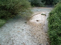
 The river Nera in Cerreto di Spoleto
 -
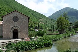
 The Nera near Terni


Related pages
changeReferences
change- ↑ "Nera" (in Italian). Treccani.it - Enciclopedie on line. Retrieved 22 July 2016.
- ↑ "Fiume Nera" (in Italian). Fiumi italiani. Retrieved 22 July 2016.
- ↑ "Acque interna - Umbria" (in Italian). Fiumi iitaliani. Retrieved 22 July 2016.
Other websites
change- Parco Fluviale del Nera website (in Italian)