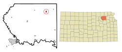
Onaga, Kansas
Onaga is a city in Pottawatomie County, Kansas, United States. As of the 2020 census, 679 people lived there.[3]
Onaga, Kansas | |
|---|---|
 Location within Pottawatomie County and Kansas | |
 | |
| Coordinates: 39°29′21″N 96°10′13″W / 39.48917°N 96.17028°W[1] | |
| Country | United States |
| State | Kansas |
| County | Pottawatomie |
| Platted | 1877 |
| Incorporated | by 1881, 1926 |
| Named for | Onago |
| Area | |
| • Total | 0.66 sq mi (1.70 km2) |
| • Land | 0.66 sq mi (1.70 km2) |
| • Water | 0.00 sq mi (0.00 km2) |
| Elevation | 1,112 ft (339 m) |
| Population | |
| • Total | 679 |
| • Density | 1,000/sq mi (400/km2) |
| Time zone | UTC-6 (CST) |
| • Summer (DST) | UTC-5 (CDT) |
| ZIP code | 66521 |
| Area code | 785 |
| FIPS code | 20-52875 |
| GNIS ID | 2396065[1] |
| Website | cityofonaga.com |
History
changeOnaga was platted in 1877 by the railroad.[4] Onaga is a Potawatomi Indian name.[5]
The first post office in Onaga was created in December 1877.[6]
Geography
changeOnaga is at 39°29′21″N 96°10′13″W / 39.48917°N 96.17028°W (39.489283, -96.170241).
According to the United States Census Bureau says that the city has a total area of 0.66 square miles (1.71 km2). All of it is land.[2]
Climate
changeOnaga has warm to hot (and often humid) summers and cold (sometimes severely cold) winters. According to the Köppen Climate Classification system says that Onaga has a humid continental climate, abbreviated "Dfa" on climate maps.[7]
People
change| Historical population | |||
|---|---|---|---|
| Census | Pop. | %± | |
| 1880 | 242 | — | |
| 1890 | 423 | 74.8% | |
| 1900 | 598 | 41.4% | |
| 1910 | 759 | 26.9% | |
| 1920 | 838 | 10.4% | |
| 1930 | 930 | 11.0% | |
| 1940 | 741 | −20.3% | |
| 1950 | 882 | 19.0% | |
| 1960 | 850 | −3.6% | |
| 1970 | 761 | −10.5% | |
| 1980 | 752 | −1.2% | |
| 1990 | 761 | 1.2% | |
| 2000 | 704 | −7.5% | |
| 2010 | 702 | −0.3% | |
| 2020 | 679 | −3.3% | |
| U.S. Decennial Census | |||
Onaga is part of the Manhattan, Kansas Metropolitan Statistical Area.
2020 census
changeAs of the 2020 census, there were 679 people, 267 households, and 156 families living in the city. Of the households, 60.3% owned their home and 39.7% rented their home.
The median age was 41.8 years. Of the people, 91.5% were White, 1.6% were Native American, 1.0% were Asian, 0.6% were Black, 0.1% were Pacific Islanders, 0.9% were from some other race, and 4.3% were two or more races. Hispanic or Latino of any race were 2.8% of the people.[3][8]
2010 census
changeAs of the 2010 census, there were 702 people, 286 households, and 166 families living in the city.[9]
References
change- ↑ 1.0 1.1 1.2 U.S. Geological Survey Geographic Names Information System: Onaga, Kansas
- ↑ 2.0 2.1 "2020 U.S. Gazetteer Files". United States Census Bureau. Retrieved November 30, 2023.
- ↑ 3.0 3.1 3.2 "DP1: PROFILE OF GENERAL POPULATION AND HOUSING CHARACTERISTICS". United States Census Bureau. Retrieved November 30, 2023.
- ↑ Blackmar, Frank Wilson (1912). Kansas: A Cyclopedia of State History, Volume 2. Standard Publishing Company. p. 391.
- ↑ Kansas State Historical Society (1916). Biennial Report of the Board of Directors of the Kansas State Historical Society. Kansas State Printing Plant. p. 263.
- ↑ "Kansas Post Offices, 1828-1961". Kansas Historical Society. Archived from the original on October 9, 2013. Retrieved 22 June 2014.
- ↑ Climate Summary for Onaga, Kansas
- ↑ "P16: HOUSEHOLD TYPE". United States Census Bureau. Retrieved January 2, 2024.
- ↑ "American FactFinder". United States Census Bureau. Retrieved 2012-07-06.
Other websites
change- City
- Schools
- USD 322 local school district
- Maps
- Onaga City Map, KDOT