Province of Rieti
The Province of Rieti (Italian: Provincia di Rieti) is a province in the Lazio region of Central Italy. Its capital is the city of Rieti.
Province of Rieti | |
|---|---|
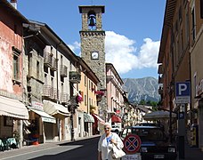
 Palazzo d'Oltre Velino, Rieti. | |
 Flag  Coat of arms | |
 Map with the province of Rieti, in red, in Italy | |
| Coordinates: 42°24′30″N 12°51′36″E / 42.40833°N 12.86000°E | |
| Country | |
| Region | Lazio |
| Capital | Rieti |
| Comuni | 73 |
| Government | |
| • President | Giuseppe Rinaldi[1] |
| Area | |
| • Total | 2,750.52 km2 (1,061.98 sq mi) |
| Population (January 2017)[3] | |
| • Total | 157,429 |
| • Density | 57/km2 (150/sq mi) |
| Time zone | UTC+1 (CET) |
| • Summer (DST) | UTC+2 (CEST) |
| Postal code | 02100 Rieti, 02010-02048 |
| Telephone prefix | 0744, 0746, 0765 |
| Vehicle registration | RI |
| ISTAT | 057 |
| Website | Official website |
History
changeThe province of Rieti was created in January of 1927 with parts of the provinces of Rome and L'Aquila.
Geography
change.svg)
The province of Rieti has an area of 2,750.52 km2 (1,061.98 sq mi),[2] the second smallest province of the Lazio region.
The province is in the northeast of the Lazio region. It borders to the west, along the Tiber river, with the Viterbo province and the Rome, to the north with the Umbria region (provinces of Perugia and Terni), and to the east by Province of Ascoli Piceno in the Marche region, and with the provinces of L'Aquila and Teramo in the Abruzzo region.
The territory of the province is mostly mountainous with the Monti Sabini and Monti Reatini to the north, on the border with the Umbria region; the Monti Terminillo and the Monti della Laga to the east; and the Monti del Cicolano and Monti della Duchessa to the southeast.
The highest mountain in the province is Monte Gorzano (42°37′6″N 13°23′44″E / 42.61833°N 13.39556°E), in the Monti della Laga in the eastern part of the province along the border with the Teramo province, with an altitude of 2,458 m (8,064 ft).[4]
The main rivers in the province are:
- Tiber;
- Velino, tributary of the Nera, 90 km long;
- Salto, tributary of the Velino, 55 km long;
- Turano, tributary of the Velino, 70 km long;
- Corno, tributary of the Nera, 56 km long.
There are several artificial lakes; the largest is the Lago del Salto with an area of 10 km2 (3.9 sq mi).
Population
changeAs of 1 January 2017[update], there are 157,429 persons living in the province,[3] for a population density of 57.2 inhabitants/km².
Evolution of the population in the province of Rieti

Administration
changeThere are 73 municipalities (or comuni) in the province; they are:
- Accumoli
- Amatrice
- Antrodoco
- Ascrea
- Belmonte in Sabina
- Borbona
- Borgo Velino
- Borgorose
- Cantalice
- Cantalupo in Sabina
- Casaprota
- Casperia
- Castel di Tora
- Castel Sant'Angelo
- Castelnuovo di Farfa
- Cittaducale
- Cittareale
- Collalto Sabino
- Colle di Tora
- Collegiove
- Collevecchio
- Colli sul Velino
- Concerviano
- Configni
- Contigliano
- Cottanello
- Fara in Sabina
- Fiamignano
- Forano
- Frasso Sabino
- Greccio
- Labro
- Leonessa
- Longone Sabino
- Magliano Sabina
- Marcetelli
- Micigliano
- Mompeo
- Montasola
- Monte San Giovanni in Sabina
- Montebuono
- Monteleone Sabino
- Montenero Sabino
- Montopoli di Sabina
- Morro Reatino
- Nespolo
- Orvinio
- Paganico Sabino
- Pescorocchiano
- Petrella Salto
- Poggio Bustone
- Poggio Catino
- Poggio Mirteto
- Poggio Moiano
- Poggio Nativo
- Poggio San Lorenzo
- Posta
- Pozzaglia Sabina
- Rieti
- Rivodutri
- Rocca Sinibalda
- Roccantica
- Salisano
- Scandriglia
- Selci
- Stimigliano
- Tarano
- Toffia
- Torri in Sabina
- Torricella in Sabina
- Turania
- Vacone
- Varco Sabino
The largest comune is Rieti, with 206.46 km2 (79.71 sq mi) and the smallest is Frasso Sabino (4.39 km2 [1.69 sq mi] ).[5] The comune with fewest people living in it is Marcetelli with 89 inhabitants.
Main comuni
changeThe following table shows the 10 comuni with more inhabitants with their population,[3] and their area and altitude.[6]
| No. | Comune | Population (2017) |
Area (km²) |
Density | Altitude (m) |
|---|---|---|---|---|---|
| 1 | Rieti | 47,552 | 206.46 | 230.3 | 405 |
| 2 | Fara in Sabina | 13,819 | 54.96 | 251.4 | 482 |
| 3 | Cittaducale | 6,786 | 71.25 | 95.2 | 481 |
| 4 | Poggio Mirteto | 6,343 | 26.40 | 240.3 | 246 |
| 5 | Borgorose | 4,542 | 145.82 | 31.1 | 732 |
| 6 | Montopoli di Sabina | 4,128 | 37.94 | 108.8 | 331 |
| 7 | Contigliano | 3,806 | 53.55 | 71.1 | 488 |
| 8 | Magliano Sabina | 3,740 | 43.23 | 86.5 | 222 |
| 9 | Forano | 3,160 | 17.69 | 178.6 | 218 |
| 10 | Scandriglia | 3,128 | 63.35 | 49.4 | 535 |
Gallery
change-
 Palazzo Comunale, Rieti.
 -
-
 Saint Michael Archangel church - Rieti.
 -
 Velino river in Rieti.
 -
 Lago del Salto from the dam.


_esterno_01.jpg)


Related pages
changeReferences
change- ↑ "Presidente" (in Italian). Provincia di Rieti. Retrieved 10 August 2017.[permanent dead link]
- ↑ 2.0 2.1 "Provincia di Rieti" (in Italian). Tuttitalia.it. Retrieved 10 August 2017.
- ↑ 3.0 3.1 3.2 "Statistiche demografiche ISTAT" (in Italian). Demo.istat.it. Archived from the original on 3 January 2018. Retrieved 23 February 2017.
- ↑ "Monte Gorzano, Italy". Peakbagger.com. Retrieved 10 August 2017.
- ↑ "Comuni in provincia di Rieti per superficie" (in Italian). Tuttitalia.it. Retrieved 10 August 2017.
- ↑ "Comuni in provincia di Rieti per popolazione" (in Italian). Tuttitalia.it. Retrieved 30 June 2017.
Other websites
change- Official Site (in Italian)