Taganrog
Taganrog (Russian: Таганрог, IPA: [təɡɐnˈrok]) is a port city in Rostov Oblast, Russia. It is on the north shore of the Taganrog Bay in the Sea of Azov, several kilometers west of the mouth of the Don River. As of the 2010 Census, its population was 257,681; the latest official estimate (as of 1 January 2019) was 248,664.[10]
Taganrog
Таганрог | |
|---|---|
 Aerial view of the port of Taganrog (2006) | |
 Flag _(1808).png) Coat of arms | |
| Anthem: Anthem of Taganrog[1] | |
Location of Taganrog  | |
 Taganrog Location of Taganrog .svg) Taganrog Taganrog (European Russia)  Taganrog Taganrog (Europe) | |
| Coordinates: 47°13′N 38°55′E / 47.217°N 38.917°E | |
| Country | Russia |
| Federal subject | Rostov Oblast |
| Founded | September 12, 1698[2] |
| City status since | 1775 |
| Government | |
| • Body | City Duma[3] |
| • Head[3] | Mikhail Solonitsin[4] |
| Area | |
| • Total | 80 km2 (30 sq mi) |
| Elevation | 30 m (100 ft) |
| Population | |
| • Total | 257,681 |
| • Estimate (January 2016)[7] | 251,100 |
| • Rank | 72nd in 2010 |
| • Density | 3,200/km2 (8,300/sq mi) |
| • Subordinated to | Taganrog Urban Okrug |
| • Capital of | Taganrog Urban Okrug |
| • Urban okrug | Taganrog Urban Okrug |
| • Capital of | Taganrog Urban Okrug |
| Time zone | UTC+3 (MSK |
| Postal code(s)[9] | 347900, 347902, 347904, 347905, 347909, 347910, 347913, 347916, 347919, 347922–347924, 347927, 347928, 347930–347932, 347935, 347936, 347939, 347942, 347943, 347949, 347990 |
| Dialing code(s) | +7 8634 |
| OKTMO ID | 60737000001 |
| City Day | September 12[2] |
| Twin towns | Badenweiler, Lüdenscheid, Cherven bryag, Mariupol, Odesa, Jining, Pinsk, Khartsyzk, Antratsyt, Famagusta Municipality |
| Website | www |
History
change| 2010 Census | 257,681[6] |
|---|---|
| 2002 Census | 281,947[11] |
| 1989 Census | 291,622[12] |
| 1979 Census | 276,444[13] |
Taganrog was founded on 12 September 1698 by Peter the Great. It was the first Russian Navy base. It held the Azov Flotilla of Catherine the Great. This flotilla later became the Russian Black Sea Fleet. Taganrog was given city status in 1775.[14]
Taganrog was used as an important port city from near the end of the 19th century until the beginning of the 20th century. It was used for the import and export of grain. The city was heavily industrialized in the early 20th century with the making of a boiler factory, an iron and steel foundry, a leather factory, and an oil press factory. Fifteen foreign consulates had opened in the city by 1911.
World War I
changeDuring World War I, Taganrog was occupied by German troops from May to August 1918. In 1919, General Anton Denikin made his headquarters in Taganrog while commanding White Russian forces fighting in South Russia during the Russian Civil War. Denikin and his remaining troops were evacuated by HMS Montrose after the Bolsheviks took the city on 25 December 1919.
World War II
changeDuring World War II, Taganrog was occupied by Nazi Germany from 1941 to 1943. The city was very damaged. It was liberated by the Red Army on 30 August 1943.
Climate
changeThe climate of Taganrog is temperate (Köppen climate classification Cfa). Taganrog has mild winters and hot summers.
| Climate data for Taganrog (1991–2020, extremes 1905–present) | |||||||||||||
|---|---|---|---|---|---|---|---|---|---|---|---|---|---|
| Month | Jan | Feb | Mar | Apr | May | Jun | Jul | Aug | Sep | Oct | Nov | Dec | Year |
| Record high °C (°F) | 10.6 (51.1) |
15.6 (60.1) |
22.0 (71.6) |
28.4 (83.1) |
35.8 (96.4) |
37.4 (99.3) |
40.5 (104.9) |
40.5 (104.9) |
35.6 (96.1) |
30.5 (86.9) |
22.7 (72.9) |
14.5 (58.1) |
40.5 (104.9) |
| Average high °C (°F) | 0.1 (32.2) |
1.3 (34.3) |
7.0 (44.6) |
15.4 (59.7) |
22.2 (72.0) |
27.1 (80.8) |
29.9 (85.8) |
29.5 (85.1) |
22.9 (73.2) |
15.0 (59.0) |
6.8 (44.2) |
1.7 (35.1) |
14.9 (58.8) |
| Daily mean °C (°F) | −2.5 (27.5) |
−1.9 (28.6) |
3.2 (37.8) |
10.9 (51.6) |
17.6 (63.7) |
22.3 (72.1) |
24.7 (76.5) |
24.1 (75.4) |
18.0 (64.4) |
11.0 (51.8) |
3.8 (38.8) |
−0.9 (30.4) |
10.9 (51.6) |
| Average low °C (°F) | −4.5 (23.9) |
−4.2 (24.4) |
0.5 (32.9) |
7.5 (45.5) |
13.6 (56.5) |
18.0 (64.4) |
20.2 (68.4) |
19.4 (66.9) |
13.8 (56.8) |
7.9 (46.2) |
1.6 (34.9) |
−2.8 (27.0) |
7.6 (45.7) |
| Record low °C (°F) | −32.0 (−25.6) |
−29.5 (−21.1) |
−23.7 (−10.7) |
−7.0 (19.4) |
−0.9 (30.4) |
4.6 (40.3) |
9.6 (49.3) |
7.3 (45.1) |
−0.2 (31.6) |
−10.3 (13.5) |
−20.9 (−5.6) |
−26.1 (−15.0) |
−32.0 (−25.6) |
| Average precipitation mm (inches) | 58 (2.3) |
48 (1.9) |
45 (1.8) |
39 (1.5) |
51 (2.0) |
59 (2.3) |
39 (1.5) |
36 (1.4) |
49 (1.9) |
42 (1.7) |
49 (1.9) |
56 (2.2) |
571 (22.5) |
| Mean monthly sunshine hours | 60 | 80 | 129 | 195 | 271 | 293 | 318 | 305 | 237 | 158 | 70 | 44 | 2,160 |
| Source 1: Pogoda.ru.net[15] | |||||||||||||
| Source 2: Climatebase (sun 1916–2012)[16] | |||||||||||||
Notable people
change
Many Russian and international aristocrats, politicians, artists, and scientists were born and/or have lived in Taganrog. Taganrog is the native city of
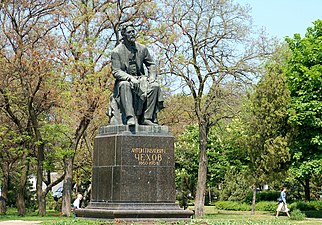
- Anton Chekhov,
- Faina Ranevskaya,
- Sophia Parnok,
- Alexandre Koyré,
- Isaac Yakovlevich Pavlovsky,
- Witold Rowicki,
- Georgy Sedov (1877–1914), Russian Arctic explorer
- Dmitri Sinodi-Popov
It is also associated with:
- Peter I of Russia,
- Alexander I of Russia,
- Cornelius Cruys,
- Giuseppe Garibaldi,
- Pyotr Tchaikovsky,
- Adolph Brodsky,
- Konstantin Paustovsky,
- Nestor Kukolnik,
- Achilles Alferaki,
- Ioannis Varvakis,
- Vasily Zolotarev,
- Sergei Bondarchuk,
- William Frederick Yeames
-

-

-
-
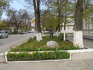 Monument "Artyomka"


Twin towns – sister cities
change Antratsyt, Ukraine (2012)
 Badenweiler, Germany (2002)
 Cherven Bryag, Bulgaria (1963)
 Jining, China (2009)
- Khartsyzk, Ukraine (2009)
- Lüdenscheid, Germany (1991)
- Odesa, Ukraine
References
change- ↑ Decision #537
- ↑ 2.0 2.1 Charter of Taganrog, Article 2
- ↑ 3.0 3.1 Charter of Taganrog, Article 12
- ↑ Official website of Taganrog. Mikhail Solonitsin, Head of the Administration of the City of Taganrog (in Russian)
- ↑ Official website of Taganrog. Information About Taganrog (in Russian)
- ↑ 6.0 6.1 Всероссийская перепись населения 2010 года. Том 1 [2010 All-Russian Population Census, vol. 1]. Всероссийская перепись населения 2010 года (2010 All-Russia Population Census) (in Russian). Federal State Statistics Service. 2011. Retrieved June 29, 2012.
- ↑ Rostov Oblast Territorial Branch of the Federal State Statistics Service. Cities with Populations of 100,000 and Over Archived 2017-07-02 at the Wayback Machine (in Russian)
- ↑ "Об исчислении времени". Официальный интернет-портал правовой информации (in Russian). 3 June 2011. Retrieved 19 January 2019.
- ↑ Почта России. Информационно-вычислительный центр ОАСУ РПО. (Russian Post). Поиск объектов почтовой связи (Postal Objects Search) (in Russian)
- ↑ Federal State Statistics Service Russia (web).
- ↑ Численность населения России, субъектов Российской Федерации в составе федеральных округов, районов, городских поселений, сельских населённых пунктов – районных центров и сельских населённых пунктов с населением 3 тысячи и более человек [Population of Russia, its federal districts, federal subjects, districts, urban localities, rural localities—administrative centers, and rural localities with population of over 3,000]. Всероссийская перепись населения 2002 года (All-Russia Population Census of 2002) (in Russian). Federal State Statistics Service. May 21, 2004. Retrieved 9 Feb 2012.
- ↑ Demoscope Weekly (1989). Всесоюзная перепись населения 1989 г. Численность наличного населения союзных и автономных республик, автономных областей и округов, краёв, областей, районов, городских поселений и сёл-райцентров. [All Union Population Census of 1989. Present population of union and autonomous republics, autonomous oblasts and okrugs, krais, oblasts, districts, urban settlements, and villages serving as district administrative centers]. Всесоюзная перепись населения 1989 года (All-Union Population Census of 1989) (in Russian). Institute of Demographics of the State University—Higher School of Economics. Retrieved 9 Feb 2012.
- ↑ invalid reference parameter
- ↑ Энциклопедия Города России. Moscow: Большая Российская Энциклопедия. 2003. pp. 454–455. ISBN 5-7107-7399-9.
- ↑ "Погода и Климат – Климат Таганрог" (in Russian). Weather and Climate (Погода и климат). Retrieved 15 November 2021.
- ↑ "Taganrog, Rostov, Russia #34720". Climatebase. Retrieved 15 November 2021.
- ↑ "Города - партнеры". tagancity.ru (in Russian). Taganrog. Retrieved 2020-02-05.
Other websites
change- Taganrogcity.com: official City of Taganrog website—(in English)
- Tagancity.ru: official website of Taganrog city—(in Russian)
- Taganrog.su: unofficial website of Taganrog Archived 2022-07-13 at the Wayback Machine—(in Russian)
- Taganrog State − Anton Chekhov Pedagogical Institute—(in Russian)
- Soviet topographic map 1:100,000
- Russ-yug.ru: Weather forecasts for Taganrog Archived 2020-08-05 at the Wayback Machine