Tai Tapu
locality in Selwyn District, Canterbury Region, New Zealand
Tai Tapu is a small town/settlement on State Highway 75. It was previously known as Taitapu. It is located 6 kilometres east of Lincoln and 18 kilometres south west of Christchurch. It has a school, church and hotel that was established in 1856. The name Tai Tapu is derived from the Maori words "wai tapu". This means water.
Tai Tapu | |
|---|---|
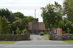
 St Paul's church, Tai Tapu | |
 | |
| Coordinates: 43°40′12″S 172°33′0″E / 43.67000°S 172.55000°E | |
| Country | New Zealand |
| Island | South Island |
| Region | Canterbury |
| Territorial authority | Selwyn District |
| Ward | Springs |
| Area | |
| • Total | 2.42 km2 (0.93 sq mi) |
| Population (2018 Census)[2] | |
| • Total | 540 |
| • Density | 220/km2 (580/sq mi) |
| Time zone | UTC+12 (NZST) |
| • Summer (DST) | UTC+13 (NZDT) |
| Local iwi | Ngāi Tahu |
References
change- ↑ "ArcGIS Web Application". statsnz.maps.arcgis.com. Retrieved 28 October 2021.
- ↑ "Statistical area 1 dataset for 2018 Census". Statistics New Zealand. March 2020. 7026976 (7026976), 7026977 (7026977) and 7026978 (7026978).