Lansing, Kansas
Lansing is a city in Leavenworth County, Kansas, United States. It is on the west side of the Missouri River and Kansas-Missouri state border. In 2020, 11,239 people lived there.[3] It is the second biggest city in Leavenworth County. It is part of the Kansas City metropolitan area.
Lansing, Kansas | |
|---|---|
 Lansing High School band marching in the 2015 Veterans Day Parade | |
 Location within Leavenworth County and Kansas | |
 | |
| Coordinates: 39°14′33″N 94°53′47″W / 39.24250°N 94.89639°W[1] | |
| Country | United States |
| State | Kansas |
| County | Leavenworth |
| Platted | 1878 |
| Incorporated | 1959 |
| Named for | James Lansing |
| Area | |
| • Total | 12.41 sq mi (32.14 km2) |
| • Land | 12.31 sq mi (31.88 km2) |
| • Water | 0.10 sq mi (0.27 km2) 0.88% |
| Elevation | 860 ft (260 m) |
| Population | |
| • Total | 11,239 |
| • Density | 910/sq mi (350/km2) |
| Time zone | UTC-6 (CST) |
| • Summer (DST) | UTC-5 (CDT) |
| ZIP code | 66043 |
| Area code | 913 |
| GNIS ID | 485607[1] |
| Website | lansingks.org |
The Lansing Correctional Facility (used to be called the Kansas State Penitentiary), which includes the state's main maximum-security prison, is in Lansing.
History
changeLansing is named for James Lansing. He was a pioneer settler.[4]
Geography
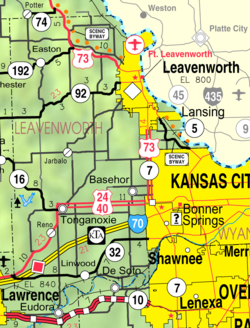
changeLansing is at 39°14′33″N 94°53′47″W / 39.24250°N 94.89639°W (39.242592, -94.89632).[2] The city is on the western bank of the Missouri River. The river also creates the Kansas-Missouri state border. It is bordered by the city of Leavenworth to the north; Kansas City is less than a half-hour to the southeast. U.S. Route 73 goes through the city.
The United States Census Bureau says that the city has a total area of 12.41 square miles (32.14 km2). Of that, 12.31 square miles (31.88 km2) is land and 0.10 square miles (0.26 km2) is water.ref name="CenPopGazetteer2020"/>
People
change| Historical population | |||
|---|---|---|---|
| Census | Pop. | %± | |
| 1880 | 933 | — | |
| 1890 | 1,468 | 57.3% | |
| 1960 | 1,264 | — | |
| 1970 | 3,797 | 200.4% | |
| 1980 | 5,307 | 39.8% | |
| 1990 | 7,120 | 34.2% | |
| 2000 | 9,199 | 29.2% | |
| 2010 | 11,265 | 22.5% | |
| 2020 | 11,239 | −0.2% | |
| U.S. Decennial Census 2010-2020[5] | |||
2020 census
changeThe 2020 census says there were 11,239 people, 3,432 households, and 2,566 families living in Lansing. Of the households, 72.4% owned their home and 27.6% rented their home.
The median age was 38.9 years. Of the people, 75.5% were White, 11.3% were Black, 1.6% were Asian, 0.7% were Native American, 0.2% were Pacific Islanders, 1.8% were from some other race, and 8.8% were two or more races. Hispanic or Latino of any race were 7.2% of the people.[3][6]
2010 census
changeThe 2010 census[7] says there were 11,265 people, 3,180 households, and 2,496 families living in Lansing.
Education
changeLansing Unified School District (USD 469), with four schools, has more than 2,000 students.[8]
- Lansing Elementary School, grades K–3
- Lansing Intermediate School, grades 4–5
- Lansing Middle School, grades 6–8
- Lansing High School, grades 9–12
References
change- ↑ 1.0 1.1 1.2 U.S. Geological Survey Geographic Names Information System: Lansing, Kansas
- ↑ 2.0 2.1 "2020 U.S. Gazetteer Files". United States Census Bureau. Retrieved November 17, 2023.
- ↑ 3.0 3.1 3.2 "DP1: PROFILE OF GENERAL POPULATION AND HOUSING CHARACTERISTICS". United States Census Bureau. Retrieved November 17, 2023.
- ↑ Heim, Michael (2007). Exploring Kansas Highways. Exploring America's Highway. p. 52. ISBN 978-0-9744358-8-6.
- ↑ "QuickFacts: Lansing city, Kansas". United States Census Bureau. Retrieved November 17, 2023.
- ↑ "P16: HOUSEHOLD TYPE". United States Census Bureau. Retrieved December 31, 2023.
- ↑ "American FactFinder". United States Census Bureau. Retrieved 2012-07-06.
- ↑ "Lansing schools". GreatSchools.net. Retrieved 2006-07-16.
Other websitess
change- City
- City of Lansing
- "Lansing - Directory of Public Officials". Archived from the original on 2015-10-26.
- Lansing, Kansas at the Open Directory Project
- Maps
- Lansing City Map, KDOT