Malden, Massachusetts
Malden is a suburban city in Middlesex County, Massachusetts, United States. The population was 66,263 at the 2020 census.[2]
Malden, Massachusetts | |
|---|---|
|
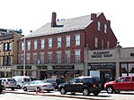
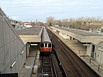
Left-right from top: Malden High School, Waitt Brick Block, Fellsmere Park, Oak Grove MBTA station | |
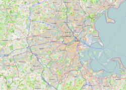
 Location in Middlesex County in Massachusetts | |
| Coordinates: 42°25′30″N 71°04′00″W / 42.42500°N 71.06667°W | |
| Country | United States |
| State | Massachusetts |
| County | Middlesex |
| Settled | 1640 |
| Incorporated | 1649 |
| City | 1882 |
| Government | |
| • Type | Mayor–council |
| Area | |
| • Total | 5.08 sq mi (13.16 km2) |
| • Land | 5.04 sq mi (13.06 km2) |
| • Water | 0.04 sq mi (0.10 km2) |
| Elevation | 13 ft (4 m) |
| Population | |
| • Total | 66,263 |
| • Density | 13,136.99/sq mi (5,072.11/km2) |
| Demonym | Maldonian[3] |
| Time zone | UTC−5 (Eastern) |
| • Summer (DST) | UTC−4 (Eastern) |
| ZIP Code | 02148 |
| Area code | 339/781 |
| FIPS code | 25-37875 |
| GNIS ID | 0612773 |
| Website | cityofmalden |
Geography
changeMalden is located at 42°25.5′N 71°4′W / 42.4250°N 71.067°W.[4] It is bordered by Melrose on the North, Everett on the south, Medford on the west, Revere on the east, and Saugus on the northeast.
Neighborhoods
changeLike many communities in New England, many towns and neighborhoods are organized around "Squares" which are locations of crossroads and town commons dating from the colonial and early 19th century years. Many of the neighborhoods in Malden take their name and identity from the Square they are centered around.
Malden's squares include Malden Square (formerly Converse Square, and the location of downtown Malden), Oak Grove Square (at Oak Grove T Station, Bellrock Square (at the intersections of Cross, Main and Medford Sts.), Judson Square (near Ferryway Green/School), former Suffolk Square (at Cross and Bryant Streets, and the location of a thriving Jewish community until being claimed by urban renewal in the 1960s), Maplewood Square (at Lebanon, Maplewood and Salem Streets) and Linden Square.
Some of the neighborhoods in Malden include Faulkner (location of the former Suffolk Square) West End, Edgeworth, Linden, Ferryway, Forestdale, Maplewood, Bellrock, and Belmont Hill (located between Bellrock and Ferryway).
References
change- ↑ "2020 U.S. Gazetteer Files". United States Census Bureau. Retrieved May 21, 2022.
- ↑ 2.0 2.1 "QuickFacts: Malden city, Massachusetts". United States Census Bureau. Retrieved March 4, 2024.
- ↑ Cardinale, Andrew (June 29, 2016). "Maldonians say no to parking sticker fees". Malden Observer. Malden, Mass. Archived from the original on October 22, 2020. Retrieved August 14, 2017.
- ↑ "US Gazetteer files: 2000 and 1990". United States Census Bureau. 2005-05-03. Retrieved 2008-01-31.
Other websites
changeMedia related to Malden, Massachusetts at Wikimedia Commons


