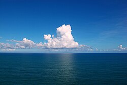
Atlantic Ocean
The Atlantic Ocean is the world's second largest ocean. It covers a total area of about 106,400,000 square kilometres (41,100,000 square miles).[1] It covers about 20 percent of the Earth's surface.[1] It is named after the god Atlas from Greek mythology.[1]
| Earth's oceans (World Ocean) |
|---|

Geologic k
changehistory
changeThe Atlantic formed when the Americas moved west from Eurasia and Africa. This began sometime in the Cretaceous period, roughly 135 million years ago. It was part of the break-up of the supercontinent Pangaea.[2]
The east coast of South America is shaped somewhat like the west coast of Africa, and this gave a clue that continents moved over long periods of time (continental drift). The Atlantic Ocean is still growing now, because of sea-floor spreading from the mid-Atlantic Ridge,[3] while the Pacific Ocean is said to be shrinking because the sea floor is folding under itself or subducting into the mantle.
Geo
changeThe Atlantic Ocean is bounded on the west by North and South America. It connects to the Arctic Ocean through the Denmark Strait, Greenland Sea, Norwegian Sea and Barents Sea.[2] It connects with the Mediterranean Sea through the Strait of Gibraltar.[4]
In the southeast, the Atlantic merges into the Indian Ocean. The 20° East meridian defines its border.[4]
In the southwest, the Drake Passage connects it to the Pacific Ocean. The Panama Canal links the Atlantic and Pacific.[2]
The Atlantic Ocean is second in size to the Pacific. It occupies an area of about 106,400,000 square kilometres (41,100,000 sq mi). The volume of the Atlantic, along with its adjacent seas (the seas next to it), is 354,700,000 cubic kilometres.[4]
The average depth of the Atlantic, along with its adjacent seas, is 3,339 metres (1,826 fathoms; 10,955 ft). The greatest depth is Milwaukee Deep near Puerto Rico, where the Ocean is 8,380 metres (4,580 fathoms; 27,490 ft) deep.[4]
The RMS Titanic currently rests at the bottom of the Atlantic Ocean.
Gulf Stream
changeThe Atlantic Ocean has important ocean currents. One of these, called the Gulf Stream, flows across the North Atlantic.[5] Water gets heated by the sun in the Caribbean Sea and then moves northwest toward the North Pole. This makes France, the British Isles, Iceland, and Norway in Europe much warmer in winter than Newfoundland and Nova Scotia in Canada.[5] Without the Gulf Stream, the climates of northeast Canada and northwest Europe might be the same, because these places are about the same distance from the North Pole.[5]
There are currents in the South Atlantic too, but the shape of this sea means that it has less effect on South Africa.
Geology
changeThe main feature of the Atlantic Ocean's seabed is a large underwater mountain chain called the Mid-Atlantic Ridge. It runs from north to south under the Ocean.[6] This is at the boundary of four tectonic plates: Eurasian, North American, South American and African.[6] The ridge extends from Iceland in the north to about 58° south.[6]
The salinity of the surface waters of the open ocean ranges from 33–37 parts per thousand and varies with latitude and season.[7]
References
change- ↑ 1.0 1.1 1.2 "How Big is the Atlantic Ocean?". National Ocean Service. National Oceanic and Atmospheric Administration, U.S. Department of Commerce. May 15, 2014. Archived from the original on December 2, 2016. Retrieved November 29, 2016.
- ↑ 2.0 2.1 2.2 "Atlantic Ocean". Eneyclopaedia Britannica. Encyclopaedia Britannica Inc. November 21, 2004. Archived from the original on February 15, 2017. Retrieved November 29, 2016.
{{cite web}}: Unknown parameter|authors=ignored (help) - ↑ "Seafloor Spreading". National Geographic. National Geographic Society. 8 June 2015. Archived from the original on 21 November 2016. Retrieved 29 November 2016.
- ↑ 4.0 4.1 4.2 4.3 "The Atlantic Ocean" (PDF). Marine Biodiversity and Ecosystem Functioning EU Network of Excellence. p. 1. Archived from the original (PDF) on September 1, 2012.
- ↑ 5.0 5.1 5.2 "Gulf Stream". Encyclopedia.com. Dictionary of American History, The Gale Group, Inc. 2003. Archived from the original on 2016-11-17. Retrieved 2016-11-29.
- ↑ 6.0 6.1 6.2 "The Mid-Atlantic Ridge". United Nations Educational, Scientific and Cultural Organization (UNESCO). UNESCO World Heritage Center. Archived from the original on 2011-05-14. Retrieved 2016-11-29.
- ↑ Talley, L.D. (2002). "Salinity Patterns in the Ocean: Volume 1, The Earth System: Physical and Chemical Dimensions of Global Environmental Change". In MacCracken, M.C.; Perry, Dr. J.S. (eds.). Encyclopedia of Global Environmental Change (PDF). John Wiley and Sons. pp. 629–640. ISBN 0-471-97796-9. Archived from the original (PDF) on 2016-12-13. Retrieved 2016-11-29.
Other websites
change- LA Times special Altered Oceans Archived 2009-05-10 at the Wayback Machine
- Oceanography Image of the Day, from the Woods Hole Oceanographic Institution
- National Oceanic and Atmospheric Administration Archived 2013-04-24 at the Wayback Machine
- NOAA In-situ Ocean Data Viewer Archived 2006-02-11 at the Wayback Machine Plot and download ocean observations
- "Atlantic Ocean". The World Factbook (2024 ed.). Central Intelligence Agency.
- 0°N 30°W / 0°N 30°W
- Oceans at the Open Directory Project
- www.cartage.org.lb Archived 2009-08-29 at the Wayback Machine
- www.mnsu.edu Archived 2010-06-03 at the Wayback Machine
