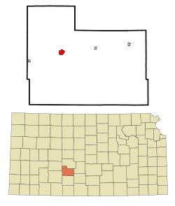
Kinsley, Kansas
Kinsley is a city in Edwards County, Kansas, United States.[4] It is also the county seat of Edwards County. In 2020, 1,456 people lived there.[3]
Kinsley, Kansas | |
|---|---|
City and County seat | |
 Water tower (2008) | |
 | |
 | |
| Coordinates: 37°55′21″N 99°24′41″W / 37.92250°N 99.41139°W[1] | |
| Country | United States |
| State | Kansas |
| County | Edwards |
| Founded | 1870s |
| Platted | 1873 |
| Incorporated | 1878 |
| Named for | E.W. Kinsley |
| Area | |
| • Total | 1.30 sq mi (3.36 km2) |
| • Land | 1.30 sq mi (3.36 km2) |
| • Water | 0.00 sq mi (0.00 km2) |
| Elevation | 2,169 ft (661 m) |
| Population | |
| • Total | 1,456 |
| • Density | 1,100/sq mi (430/km2) |
| Time zone | UTC-6 (CST) |
| • Summer (DST) | UTC-5 (CDT) |
| ZIP code | 67547 |
| Area code | 620 |
| FIPS code | 20-37075 |
| GNIS ID | 485603[1] |
| Website | kinsleyks.com |
History
changeKinsley was first called Petersburg. In 1873, the city was planned out as Petersburg. It was later renamed Peter's City, and finally the name Kinsley was chosen to honor E. W. Kinsley. He was a capitalist from Boston.[5][6]
The first post office in Kinsley was established under the name Peters in April, 1873. The post office was renamed Kinsley in January, 1874.[7]
Geography
changeKinsley is at 37°55′21″N 99°24′41″W / 37.92250°N 99.41139°W (37.922377, -99.411407). The United States Census Bureau says that the city has a total area of 1.30 square miles (3.37 km2). All of it is land.[2]
Kinsley is about 35 miles (56 km) east of Dodge City.
Climate
changeKinsley has hot, humid summers and generally mild to cool winters. The Köppen Climate Classification system says that Kinsley has a humid subtropical climate, abbreviated "Cfa" on climate maps.[8]
Area attractions
change- Edwards County Historical Sod House and Museum
- Carnival Heritage Center & Museum, 200 E 6th.[9][10]
- Half Way Sign. The sign says the distances to San Francisco and New York City are identical at 1,561 miles (2,512 km).[11]
People
change| Historical population | |||
|---|---|---|---|
| Census | Pop. | %± | |
| 1880 | 457 | — | |
| 1890 | 771 | 68.7% | |
| 1900 | 780 | 1.2% | |
| 1910 | 1,547 | 98.3% | |
| 1920 | 1,986 | 28.4% | |
| 1930 | 2,270 | 14.3% | |
| 1940 | 2,178 | −4.1% | |
| 1950 | 2,479 | 13.8% | |
| 1960 | 2,263 | −8.7% | |
| 1970 | 2,212 | −2.3% | |
| 1980 | 2,074 | −6.2% | |
| 1990 | 1,875 | −9.6% | |
| 2000 | 1,658 | −11.6% | |
| 2010 | 1,457 | −12.1% | |
| 2020 | 1,456 | −0.1% | |
| U.S. Decennial Census | |||
2020 census
changeThe 2020 census says that there were 1,456 people, 660 households, and 378 families living in Kinsley. Of the households, 72.3% owned their home and 27.7% rented their home.
The median age was 45.5 years. Of the people, 83.4% were White, 0.8% were Black, 0.4% were Native American, 0.1% were Asian, 6.0% were from some other race, and 9.4% were two or more races. Hispanic or Latino of any race were 19.1% of the people.[3][12]
2010 census
changeThe 2010 census says that there were 1,457 people, 654 households, and 384 families living in Kinsley.[13]
Famous people
change- Madge Blake, (1899–1969), actress (Batman)
- Kyle Burkhart, former NFL/CFL offensive lineman
- Freedy Johnston, singer/songwriter
- Peter Mehringer, men's freestyle wrestling gold medal at 1932 Summer Olympics.
- Earl Winfield Spencer Jr., first commanding officer of Naval Air Station, San Diego, California, and first husband of Wallis, Duchess of Windsor
References
change- ↑ 1.0 1.1 1.2 U.S. Geological Survey Geographic Names Information System: Kinsley, Kansas
- ↑ 2.0 2.1 "2020 U.S. Gazetteer Files". United States Census Bureau. Retrieved November 17, 2023.
- ↑ 3.0 3.1 3.2 "DP1: PROFILE OF GENERAL POPULATION AND HOUSING CHARACTERISTICS". United States Census Bureau. Retrieved November 17, 2023.
- ↑ "Find a County". National Association of Counties. Archived from the original on 2011-05-31. Retrieved 2011-06-07.
- ↑ Kansas State Historical Society (1916). Biennial Report of the Board of Directors of the Kansas State Historical Society. Kansas State Printing Plant. p. 183.
- ↑ "Profile for Kinsley, Kansas". ePodunk. Archived from the original on 19 June 2017. Retrieved 9 June 2014.
- ↑ "Kansas Post Offices, 1828-1961 (archived)". Kansas Historical Society. Archived from the original on 9 October 2013. Retrieved 8 June 2014.
- ↑ Climate Summary for Kinsley, Kansas
- ↑ Carnival Museum 1
- ↑ Carnival Museum 2[permanent dead link]
- ↑ Brackman, Barbara (1997). Kansas Trivia. Thomas Nelson Inc. p. 12. ISBN 9781418553814.
- ↑ "P16: HOUSEHOLD TYPE". United States Census Bureau. Retrieved December 31, 2023.
- ↑ "American FactFinder". United States Census Bureau. Retrieved 2012-07-06.
Other websites
change- City
- Schools
- USD 347 Archived 2014-12-18 at the Wayback Machine, local school district
- Historical
- Maps
- Kinsley City Map, EdwardsCounty.org
- Kinsley City Map, KDOT