Rhode Island
Rhode Island is the smallest state in the United States by area. The capital and largest city is Providence. It is called the "Ocean state" because of its bays and waterways. It was founded by Roger Williams for religious freedom. The Narragansett people lived there before Europeans came, but people like Roger Williams didn't respect them and used the land for their own reasons. The colonists fought a war against the native people and many of them were killed or ran away from the colonists.[6]
Rhode Island | |
|---|---|
| State of Rhode Island | |
| Nickname(s): The Ocean State Little Rhody[1] | |
| Motto: Hope | |
| Anthem: "Rhode Island's It for Me" | |
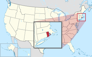
 Map of the United States with Rhode Island highlighted | |
| Country | United States |
| Before statehood | Colony of Rhode Island and Providence Plantations |
| Admitted to the Union | May 29, 1790 (13th) |
| Capital (and largest city) | Providence |
| Largest county or equivalent | Providence |
| Largest metro and urban areas | Greater Boston (combined) Providence (metro and urban) |
| Government | |
| • Governor | Dan McKee (D) |
| • Lieutenant Governor | Sabina Matos (D) |
| Legislature | Rhode Island General Assembly |
| • Upper house | Senate |
| • Lower house | House of Representatives |
| Judiciary | Rhode Island Supreme Court |
| U.S. senators | Jack Reed (D) Sheldon Whitehouse (D) |
| U.S. House delegation | 1: Vacant 2: Seth Magaziner (D) (list) |
| Area | |
| • Total | 1,545[a][2] sq mi (4,001 km2) |
| • Land | 1,055 sq mi (2,707 km2) |
| • Water | 169 sq mi (438 km2) 13.9% |
| • Rank | 50th |
| Dimensions | |
| • Length | 48 mi (77 km) |
| • Width | 37 mi (60 km) |
| Elevation | 200 ft (60 m) |
| Highest elevation | 812 ft (247 m) |
| Lowest elevation (Atlantic Ocean[3]) | 0 ft (0 m) |
| Population (2020 Census Results) | |
| • Total | 1,098,163[4] |
| • Rank | 45th |
| • Density | 1,006/sq mi (388/km2) |
| • Rank | 2nd |
| • Median household income | $63,870[5] |
| • Income rank | 15th |
| Demonym | Rhode Islander |
| Language | |
| • Official language | De jure: None De facto: English |
| Time zone | UTC– 05:00 (Eastern) |
| • Summer (DST) | UTC– 04:00 (EDT) |
| USPS abbreviation | RI |
| ISO 3166 code | US-RI |
| Traditional abbreviation | R.I. |
| Latitude | 41° 09′ N to 42° 01′ N |
| Longitude | 71° 07′ W to 71° 53′ W |
| Website | www |

| Rhode Island state symbols | |
|---|---|
 | |
 | |
| Living insignia | |
| Bird | Rhode Island Red chicken Gallus gallus domesticus |
| Fish | Striped bass |
| Flower | Violet Viola sororia |
| Insect | American burying beetle Nicroforus americanus |
| Mammal | Morgan horse |
| Reptile | Painted turtle |
| Tree | Red Maple Acer rubrum |
| Inanimate insignia | |
| Beverage | Coffee milk |
| Colors | White and Blue |
| Mineral | Bowenite |
| Rock | Cumberlandite |
| Ship | Courageous, USS Providence |
| Slogan | Unwind |
| Tartan | Rhode Island State Tartan |
| Other | Fruit: Rhode Island Greening |
| State route marker | |
 | |
| State quarter | |
 Released in 2001 | |
| Lists of United States state symbols | |
Rhode Island was one of the original Thirteen Colonies. It became very important to the economy because of the slave trade, and more slaves were taken to the thirteen colonies through Rhode Island than any of the others in the 18th century. Slavers would send ships from Newport to buy slaves from Africa and make money by trading goods with others involved in slavery.[7] Rhode Island became a state (the last of the thirteen to agree to the new United States Constitution) in 1790. But despite it joined the United States in 1790, it was founded in 1776.
Rhode Island is bordered on the north and east by Massachusetts, on the west by Connecticut, and on the south by Rhode Island Sound and the Atlantic Ocean. It shares a water border with New York. It is named for a large island in Rhode Island Sound, Rhode Island. Some thought the island looked liked Rhodes, an island in Greece.
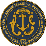
An executive order was signed by Governor Gina Raimondo on June 22, 2020 to remove "Providence Plantations" from the official state name due to its ties to slavery. [8] Raimondo stated the change would go into effect "as soon as practicable." [9] In November 2020, the official name was voted to be changed to "State of Rhode Island".
Related pages
changeNotes
changeReferences
change- ↑ "Rhode Island Government: Government". RI.gov. Archived from the original on July 1, 2010. Retrieved July 31, 2010.
- ↑ "State Area Measurements and Internal Point Coordinates".
- ↑ 3.0 3.1 "Elevations and Distances in the United States". United States Geological Survey. 2001. Archived from the original on October 15, 2011. Retrieved October 24, 2011.
- ↑ Bureau, US Census (2021-04-26). "2020 Census Apportionment Results". The United States Census Bureau. Archived from the original on April 26, 2021. Retrieved 2021-04-27.
{{cite web}}:|last=has generic name (help) - ↑ "Median Annual Household Income". The Henry J. Kaiser Family Foundation. Archived from the original on December 20, 2016. Retrieved December 9, 2016.
- ↑ "Native Americans - Rhode Island - Nellie M. Gorbea". www.sos.ri.gov. Retrieved 2020-10-25.
- ↑ Clark-Pujara, Christy (30 August 2016). Dark Work: The Business of Slavery in Rhode Island. NYU Press. ISBN 9781479809943.
- ↑ Rhode Island moves to change its official name due to slavery ties
- ↑ Rhode Island moves to change official name over slavery ties
Other websites
changeMedia related to Rhode Island at Wikimedia Commons

