Ascension Island
Ascension Island is an isolated and relatively young volcanic island in the South Atlantic Ocean, some 100 km (62 mi) west of the mid-Atlantic Ridge, 1,504 km (935 mi) from Liberia (Cape Palmas), and 2,232 km (1,387 mi) from Brazil (Recife). The nearest land is Saint Helena, 1,296 km (805 mi) to the south-east.[1]
Ascension Island | |
|---|---|
Overseas territory of the UK | |
 The island viewed from atop Green Mountain. | |
 Flag  Coat of arms | |
| Anthem: God Save the Queen | |
 Location of Ascension Island in the Atlantic Ocean. | |
| Coordinates: 7°56′S 14°22′W / 7.933°S 14.367°W | |
| Country | |
| Overseas territory | Saint Helena, Ascension and Tristan da Cunha |
| Island | Ascension |
| Capital | Georgetown |
| First inhabited | 1815 |
| Current constitution | 2009 |
| Named for | Ascension Day |
| Government | |
| • Type | Monarchy |
| • Monarch | Charles III |
| • Governor | Mark Capes |
| • Administrator of Ascension Island | Colin Wells |
| Area | |
| • Total | 88 km2 (34 sq mi) |
| Highest elevation | 859 m (2,818 ft) |
| Lowest elevation | 0 m (0 ft) |
| Population | |
| • Estimate (2010) | 880 |
| • Density | 10/km2 (30/sq mi) |
| Time zone | UTC+0 (GMT) |
| Area code | +247 |
| Internet TLD | .ac |
| Currency | Saint Helena pound (SHP) (US$ accepted) |
| Website | www.ascension-island.gov.ac |
The Ascension Island is named after the day of its recorded discovery, Ascension Day. It is part of the British Overseas Territory of Saint Helena, Ascension and Tristan da Cunha,[2] of which the main island is St Helena.
The island is the location of a Royal Air Force station with a United States Air Force presence, a European Space Agency station and the BBC World Service Atlantic Relay Station. There is in the island one antenna of the five that assist in the operation of the Global Positioning System (GPS) navigational system (others are on Kwajalein Island, Diego Garcia, Colorado Springs and Hawaii).
History
changeThe Galician explorer João da Nova, working for Portugal, saw the Ascension island in the South Atlantic in 1501, when he was going to India; named it ilha da Conceição (Conception Island). En 1503 when the Portuguese navigator Afonso de Albuquerque saw the island on Ascension Day, in the church calendar, he named it after the feast day.[3]
Organised settlement of Ascension Island began in 1815, when the British sent soldiers to the island as a precaution after imprisoning Napoleon I on Saint Helena to the southeast.[3]
In 1836, Charles Darwin visited the Saint Helena and Ascension islands during his voyage in the Beagle. He described Ascension as an arid treeless island, with nothing growing near the coast. Sparse vegetation inland supported "about six hundred sheep, many goats, a few cows & horses", and large numbers of guineafowl imported from the Cape Verde islands, as well as rats, mice and land crabs.[4]
In 1843, botanist and explorer Joseph Hooker visited the island. Four years later, Hooker advised the Royal Navy that with the help of Kew Gardens, they should develop a long-term plan of shipping trees to Ascension. So, from 1850 and continuing year on year, ships came each with different plants from botanical gardens in Argentina, Europe and South Africa. By the late 1870s Norfolk pines, eucalyptus, bamboo, and banana trees grew at the highest point of the island, Green Mountain, creating a tropical forest covered with clouds.[5]
In 1899, the Eastern Telegraph Company (now part of Vodafone) installed the first underwater cable from the island, connecting the UK with its colonies in South Africa.[3] In 1922, the Ascension island was made a dependency of Saint Helena.[3] The island was managed by the head of the Eastern Telegraph Company on the island until 1964 when the British Government appointed an Administrator to represent the Governor of Saint Helena on Ascension.[3]
In 1981, the British government changed the status of Saint Helena and the other Crown colonies to "British Dependent Territories".
In 2009, Saint Helena and its two territories received equal status under a new constitution, and the British Overseas Territory was renamed Saint Helena, Ascension and Tristan da Cunha.
Geography
change
The island is roughly triangular in plan, about 13 km across, with an area of 88 km2 (34 sq mi), and has about 100 km of coastline. While the west and north-west coasts have sandy beaches, the south and southeast coasts form steep cliffs.[1]
The highest point of the island is Green Mountain, or just The Peak (7°57′S 14°21′W / 7.950°S 14.350°W), which is 859 m (2,818 ft) high. Other high mountains are Weather Post (680 m - 1,995 ft), White Hill (525 m - 1,722 ft) and Sisters Peak (445 m - 1,460 ft).
There are several small islands (islets) and rocks surrounding the Ascension Island; the largest is Boatswainbird Island, 305 m (1,001 ft) north of the eastern part of the island.[1]
Climate
changeAscension island has a tropical but oceanic climate, with little changes from one season to another. The island is in the path of the South-East Trade Winds, and southeast and easterly winds blow for more than half of every month.[1]
The Köppen climate classification subtype for this climate is Am (Tropical Monsoon Climate).[6]
The temperature is constant throughout the year. Monthly average maximum temperatures at sea-level vary only between about 27 °C and 31 °C. At 660 m on Green Mountain maximum temperatures are typically about 13 °C lower and minimum temperatures about 7 °C lower than at sea-level. The relative humidity at sea-level is around 70%.[1]
The average temperature for the year in Georgetown is 25.6 °C (78.0 °F). The warmest month, on average, is March with an average temperature of 27.8 °C (82.0 °F). The coolest month on average is August, with an average temperature of 24.4 °C (76.0 °F).[6]
| Climate data for Georgetown, Ascension Island | |||||||||||||
|---|---|---|---|---|---|---|---|---|---|---|---|---|---|
| Month | Jan | Feb | Mar | Apr | May | Jun | Jul | Aug | Sep | Oct | Nov | Dec | Year |
| Average high °C (°F) | 27 (81) |
28 (82) |
29 (84) |
29 (84) |
28 (82) |
27 (81) |
26 (79) |
26 (79) |
26 (79) |
26 (79) |
26 (79) |
27 (81) |
27 (81) |
| Average low °C (°F) | 23 (73) |
25 (77) |
25 (77) |
25 (77) |
25 (77) |
23 (73) |
23 (73) |
22 (72) |
22 (72) |
22 (72) |
22 (72) |
23 (73) |
23 (74) |
| Source: Weatherbase.com [1] | |||||||||||||
Demographics
change
The human population is about 1,000, made up of civilians working for the RAF and USAF, and a small number of military personnel. The personnel are mainly from the UK, USA and St Helena, none of whom are permanent residents.[1]
There are five settlements:
- Georgetown (the main civilian settlement and capital of the island)
- Two Boats (a civilian village, with its school)
- Cat Hill (the United States' main base on the island)
- Traveller's Hill (Royal Air Force base)
- Wideawake Airfield (with the Royal Air Force station)
Two Boats School is the only school on the island and provides education to all resident children 3½–16 years old.
Related pages
changeGallery
change-
 Ascension Island.
 -
 Wideawake Airfield.
 -
 Georgetown in the distance, from atop Green Mountain.
 -
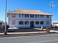 Ascension Government House.
 -
 The island's post office in Georgetown.
 -
 Ascension Island from the south.
 -
 Comfortless Cove
 -
 Black volcanic rocks.

.JPG)


References
change- ↑ 1.0 1.1 1.2 1.3 1.4 1.5 Rowlands, Beau W. "St Helena (to UK)" (PDF). IBAS. BirdLife International. Archived from the original (PDF) on 18 August 2014. Retrieved 8 May 2013.
- ↑ "The St Helena, Ascension and Tristan da Cunha Constitution Order 2009". legislation.gov.uk. Retrieved 1 May 2013.
- ↑ 3.0 3.1 3.2 3.3 3.4 "Ascension History". mysterra.org. Mysterra Magazine. Archived from the original on 13 June 2017. Retrieved 7 May 2013.
- ↑ Keynes, R.D. "Charles Darwin's Beagle diary". The Complete Work of Charles Darwin Online. Darwin Online. Retrieved 8 May 2013.
- ↑ David M. Wilkinson (January 2004). "The parable of Green Mountain: Ascension Island, ecosystem construction and ecological fitting". Journal of Biogeography. 31 (1): 4. doi:10.1046/j.0305-0270.2003.01010.x. S2CID 59332510.
- ↑ 6.0 6.1 "Georgetown, Ascension Island Köppen Climate Classification". Weatherbase. Retrieved 7 May 2013.
Other websites
change- Official Ascension Island Government site
- Ascension Island Government
- Ascension Island Newsletter Archived 2008-12-01 at the Wayback Machine
- Ascension Conservation Archived 2010-03-09 at the Wayback Machine
- Encyclopedia Astronautica - Rocket launches from Ascension
- Global Volcanism Program: Ascension Island Archived 2009-04-30 at the Wayback Machine
- Detailed description of the BBC Atlantic Relay Station
- Colonial History of Ascension Island
- Ascension Island at Britlink – British Islands & Territories Archived 2010-09-13 at the Wayback Machine
- Army Ornithological Society Ascension Island Research Archived 2012-03-02 at the Wayback Machine
- Ascension Island & St Helena community website Archived 2013-12-07 at the Wayback Machine