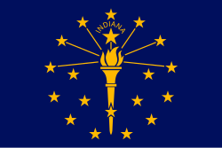
Indiana
Indiana is a U.S. state in the midwestern and Great Lakes regions of North America. Its capital and largest city is Indianapolis. Other cities and towns include Bloomington, Gary, Fort Wayne, South Bend, Evansville, Muncie, Lafayette, and Marion. People who live in Indiana are sometimes called Hoosiers.
Indiana | |
|---|---|
| State of Indiana | |
| Nickname: "The Hoosier State" | |
| Motto: | |
| Anthem: "On the Banks of the Wabash, Far Away" [1] | |
 Map of the United States with Indiana highlighted | |
| Country | United States |
| Before statehood | Indiana Territory |
| Admitted to the Union | December 11, 1816 (19th) |
| Capital (and largest city) | Indianapolis |
| Largest county or equivalent | Marion |
| Largest metro and urban areas | Indianapolis |
| Government | |
| • Governor | Eric Holcomb (R) |
| • Lieutenant Governor | Suzanne Crouch (R) |
| Legislature | General Assembly |
| • Upper house | Indiana Senate |
| • Lower house | Indiana House of Representatives |
| Judiciary | Indiana Supreme Court |
| U.S. senators |
|
| U.S. House delegation |
|
| Area | |
| • Total | 36,418 sq mi (94,321 km2) |
| • Land | 35,868 sq mi (92,897 km2) |
| • Water | 550 sq mi (1,424 km2) 1.5% |
| • Rank | 38th |
| Dimensions | |
| • Length | 270 mi (435 km) |
| • Width | 140 mi (225 km) |
| Elevation | 700 ft (210 m) |
| Highest elevation | 1,257 ft (383 m) |
| Lowest elevation | 320 ft (97 m) |
| Population (2020) | |
| • Total | 6,785,528[3] |
| • Rank | 17th |
| • Density | 189/sq mi (73.1/km2) |
| • Rank | 16th |
| • Median household income | $62,743 (2,021)[4] |
| • Income rank | 37th |
| Demonym | Hoosier |
| Language | |
| • Official language | English |
| Time zones | |
| 80 counties | UTC−05:00 (Eastern) |
| • Summer (DST) | UTC−04:00 (EDT) |
| 12 counties | UTC−06:00 (Central) |
| • Summer (DST) | UTC−05:00 (CDT) |
| USPS abbreviation | IN |
| ISO 3166 code | US-IN |
| Traditional abbreviation | Ind. |
| Latitude | 37° 46′ N to 41° 46′ N |
| Longitude | 84° 47′ W to 88° 6′ W |
| Website | in |
| Indiana state symbols | |
|---|---|
 | |
 | |
| Living insignia | |
| Bird | Cardinal |
| Fish | Largemouth bass |
| Flower | Peony |
| Insect | Say's Firefly[5] |
| Tree | Tulip tree |
| Inanimate insignia | |
| Colors | Blue and gold |
| Firearm | Grouseland Rifle |
| Food | Sugar cream pie |
| Poem | "Indiana" |
| Rock | Salem Limestone |
| Ship | USS Indianapolis (4), USS Indiana (4) |
| Slogan | Honest to Goodness Indiana |
| Soil | Miami |
| Sport | Basketball |
| Other | River: Wabash |
| State route marker | |
 | |
| State quarter | |
 Released in 2002 | |
| Lists of United States state symbols | |
Indiana's state bird is the cardinal. Indiana's state flower is the peony. Indiana's state tree is a tulip tree.
Indiana has borders with four other states: Illinois, Kentucky, Michigan, and Ohio. It also touches Lake Michigan, which is the only one of the Great Lakes that is completely inside the United States.
History
changeBefore it was called Indiana, most people who lived there were indigenous. France colonized the area, renaming it New France. They enslaved the indigenous peoples, and introduced black slaves.[6] In the 18th century, the United States took the area from France. Many slave owners from Kentucky and Virginia moved into the area.[7] By 1820, it had become a state called Indiana. The government ordered all slaves to be freed, but black people were still enslaved there into at least the 1830s.[8]
Attractions
changeOne attraction of Indiana is the Indianapolis Motor Speedway, where the Indianapolis 500 is held every year. The Indianapolis 500 is one of the biggest car races in the United States. The Indianapolis Motor Speedway is not actually in Indianapolis. It is in a town called Speedway, which is completely surrounded by Indianapolis.
Sports
changeThe Indianapolis 500 car race is based in Indianapolis. Professional sports teams include the Indianapolis Colts of the National Football League (NFL) and the Indiana Pacers of the National Basketball Association (NBA). Colleges and universities in Indiana with well-known sports teams include Purdue University, the University of Notre Dame, and Indiana University.
State Capitol
changeThe Indiana Statehouse is the official State Capitol Complex of the State of Indiana
Related pages
changeReferences
change- ↑ 1.0 1.1 Elevation adjusted to North American Vertical Datum of 1988.
- ↑ "Indiana State Song". in.gov. Indiana Historical Bureau. December 7, 2020. Retrieved November 6, 2022.
The song entitled, "On the Banks of the Wabash, Far Away," words and music by Paul Dresser, be and is hereby established as the state song of Indiana. (Ind. Code § 1-2-6-1)
- ↑ 2.0 2.1 "Elevations and Distances in the United States". United States Geological Survey. 2001. Retrieved October 21, 2011.
- ↑ Resident Population Data. "Resident Population Data – 2020 Census" (PDF). United States Census Bureau.
- ↑ "Median Annual Household Income". The Henry J. Kaiser Family Foundation. November 17, 2022. Retrieved April 8, 2023.
- ↑ "Lightning bug becomes Indiana's official state insect". 13 WTHR Indianapolis. February 27, 2018. Archived from the original on February 28, 2018. Retrieved January 25, 2019.
- ↑ Jacob Piatt Dunn (1888). Indiana: A Redemption from Slavery. University of Michigan. Houghton, Mifflin & Co.
- ↑ McCord, Shirley S. (1970). Travel Accounts of Indiana, 1679-1961: A Collection of Observations by Wayfaring Foreigners, Itinerants, and Peripatetic Hoosiers. Indiana Historical Bureau. ISBN 9781885323248.
- ↑ Rosenberg, Morton M.; McClurg, Dennis V. (1968). The Politics of Pro-Slavery Sentiment in Indiana 1816-1861. Ball State University.
Some Hoosiers continued to ignore the Lasselle verdict as the Federal Census of 1830 indicated, for three slaves were registered as still residing in Indiana. Moreover, a local census in Vincennes and Knox County revealed thirty-two slaves there.
Other websites
changeMedia related to Indiana at Wikimedia Commons

