Bratislava
Bratislava is the capital city of Slovakia. About 450,000 people live there. It used to be called Pressburg (German) or Pozsony (Hungarian) and by some other names. Bratislava is the seat of the national government, the presidency, and the parliament. It has several museums, galleries, and other educational, cultural, and economic institutions.
Bratislava | |
|---|---|
Bratislava montage. From top left to right: View of Bratislava, View of Old Town, Financial District, Old Town streets, Blue Church, Grassalkovich Palace. | |
|
| |
| Nicknames: Beauty on the Danube, Little Big City, Blava | |
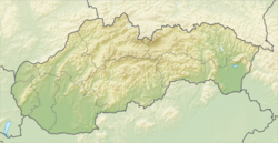
Location of Bratislava in Slovakia | |
| Coordinates: 48°08′38″N 17°06′35″E / 48.14389°N 17.10972°E | |
| Country | Slovakia |
| Region | Bratislava |
| First mentioned | 907 |
| Government | |
| • Mayor | Matúš Vallo |
| Area | |
| • Capital city | 367.584 km2 (141.925 sq mi) |
| • Urban | 853.15 km2 (329.40 sq mi) |
| • Metro | 2,053 km2 (792.66 sq mi) |
| Elevation | 134 m (440 ft) |
| Population (2021[1]) | |
| • Capital city census | 475,503 |
| • Capital city estimate | 666,000 |
| • Capital city estimate density | 1,812/km2 (4,690/sq mi) |
| Demonym(s) | Bratislavčan (m), Bratislavčanka (f) (sk) Bratislavan (en) |
| Time zone | UTC+1 (CET) |
| • Summer (DST) | UTC+2 (CEST) |
| Postal code | 8XX XX |
| Area code | 421 2 |
| Car plate | BA, BL, BT |
| GRP (Metro)[2] | 2019 |
| – Total | €26.4 billion ($30B) |
| – Per capita | €40,000 ($44779) |
| Website | www.bratislava.sk/ |
There is a small Old Town and a castle called Bratislavský Hrad. The Danube river goes through Bratislava.
Etymology
changeBratislava had many names through its history. Here are some of them:
- German: Preßburg (now spelled Pressburg)
- Slovak: Prešporok, from German name
- Hungarian: Pozsony (still used today by Hungarians)
- Greek (medieval): Istropolis (meaning the Danube City)
- Latin: Posonium
- English: Pressburg(h)/Pressborough
and many others.
Geography
changeBratislava is in the extreme southwest of Slovakia, on the borders with Austria and Hungary, and not far from the Czech Republic border. It is on the Morava and Danube rivers.
History
changePeople have lived here since the Neolithic age. The Celts inhabited this area from 400 BC-50 BC. The Roman Empire set up border military camps near Bratislava from the 1st century until the 5th century, for example,"Gerulata." The Slavs started moving here in the 6th century. Bratislava was part of the Slavic empire called Great Moravia in the 9th century. From the second half of the 10th century until 1918, it was part of the Kingdom of Hungary, with some exceptions. It was even the capital of the Kingdom between 1524 and 1830/1848. After the World War I ended in 1918, it was part of newly founded Czechoslovakia until 1939, when it became the capital of World War II the Slovak Republic until 1945. After 1945, it was part of Czechoslovakia again, becoming the capital of Slovak Socialist Republic (which was still part of Czechoslovakia) in 1968. After the event called Velvet Divorce, when Czechoslovakia broke up, Bratislava became the capital of Slovakia.
Sightseeing
changeList of notable structures:
Economy
changeThe economy of Bratislava is prosperous and based on the automobile industry, chemical industry, and services. Unemployment (people without work) is the lowest in Slovakia (around 2%, compared to the national average of 7%). Approximately 250,000 people from all over Slovakia travel to Bratislava for work.
Transport
changeThe position of Bratislava made it a natural crossroads for international traffic. It is a motorway and rail junction with its own international airport. The international river traffic passes along the Danube through Bratislava, with its own river port.
Bratislava has its own public transport system, with buses, trams and trolleybuses.
Territorial division
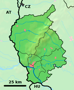
changeBratislava is divided into 5 national districts and 17 city parts:
- District I: Staré mesto (Old Town)
- District II: Ružinov, Vrakuňa, Podunajské Biskupice
- District III: Rača, Nové mesto (New Town), Vajnory
- District IV: Karlova Ves, Dúbravka, Devín, Devínska Nová Ves, Záhorská
- District V: Petržalka, Jarovce, Rusovce, Čunovo
Further it is divided into 20 cadastral areas, which are identical with the city parts with 2 exceptions:
- Nové mesto = Nové mesto + Vinohrady
- Ružinov = Ružinov + Nivy + Trnávka
Twin towns
change- Yerevan, Armenia
- Vienna, Austria
- Ruse, Bulgaria
- Larnaka, Cyprus
- Prague, Czech Republic
- Alexandria, Egypt
- Turku, Finland
- Bremen, Germany
- Ulm, Germany
- Thessaloniki, Greece
- Székesfehérvár, Hungary
- Perugia, Italy
- Rotterdam, Netherlands
- Kraków, Poland
- Ljubljana, Slovenia
- İzmir, Turkey
- Kyiv, Ukraine
- Cleveland, USA
Pictures
change-
Panorama of Bratislava
-
Panorama of Bratislava
-
Bratislava Castle
-
Slovak National Theatre
-
The Grassalkovich Palace
-
St. Martin's Cathedral
-
Kalvínsky kostol
-
Streets of the Old Town
-
Bratislava Old Town
-
Laurinská Street
References
change- ↑ "Bratislava finds census results as positive". Pravda.sk. Retrieved 2021-12-31.
- ↑ "Database - National accounts - Eurostat".


