Laos
Lao People's Democratic Republic or Laos (ປະເທດລາວ), is a country in Southeast Asia. The capital of Laos is Vientiane.
Lao People's Democratic Republic ສາທາລະນະລັດ ປະຊາທິປະໄຕ ປະຊາຊົນລາວ Sathalanalat Paxathipatai Paxaxôn Lao | |
|---|---|
 Emblem
| |
| Motto: "ສັນຕິພາບ ເອກະລາດ ປະຊາທິປະໄຕ ເອກະພາບ ວັດທະນາຖາວອນ" "Peace, independence, democracy, unity and prosperity" | |
| Anthem: Pheng Xat Lao "Hymn of the Lao People" | |
![Location of Laos (red) in ASEAN (dark grey) — [Legend]](/wiki/File:Laos_in_its_region.svg) | |
| Capital and largest city | Vientiane 17°58′N 102°36′E / 17.967°N 102.600°E |
| Official languages | Lao |
| Recognised languages | French |
| Other languages | English |
| Demonym(s) | Laotian, Lao |
| Government | Unitary
Marxist-Leninist communist and single-party state |
| Thongloun Sisoulith | |
| Sonexay Siphandone | |
| Bounthong Chitmany | |
| Pany Yathotou | |
| Saysomphone Phomvihane | |
| Independence From France | |
• Autonomy | 19 July 1949 |
• Declared | 9 Nov 1953 |
| Area | |
• Total | 236,800 km2 (91,400 sq mi) (83rd) |
• Water (%) | 2 |
| Population | |
• 2009 estimate | 6,800,000 [1] (104th) |
• 1995 census | 4,574,848 |
• Density | 26.7/km2 (69.2/sq mi) (177th) |
| GDP (PPP) | 2010 estimate |
• Total | $15.693 billion[2] (130th) |
• Per capita | $2,435[2] (48th) |
| GDP (nominal) | 2010 estimate |
• Total | $6.341 billion[2] (137th) |
• Per capita | $984[2] (147th) |
| Gini (2008) | 34.6 medium |
| HDI (2010) | low · 122nd |
| Currency | Kip (LAK) |
| Time zone | UTC+7 |
| Driving side | right |
| Calling code | 856 |
| ISO 3166 code | LA |
| Internet TLD | .la |

Laos is landlocked (it does not have a coast on a sea or ocean), and it is the only landlocked country in Southeast Asia. It is bordered by Myanmar (used to be known in English as "Burma") and by China to the northwest, by Vietnam to the east, by Cambodia to the south and by Thailand to the west. The Mekong river forms a large part of the western boundary with Thailand. Boats from Laos cannot get to the ocean using the Mekong because of rapids and waterfalls in the south of the country.[4]
Since the country has many mountains, has no access to seaports, and has few large river valleys good for large-scale farming, Laos has had few people compared to other Southeast Asian countries. Laos is the least densely populated country in Southeast Asia, with only 32 people per square kilometer.[5]
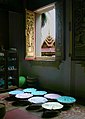
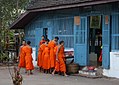
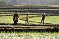
The official language is Lao, a language belonging to the Tai language group. 98% of Lao people believe in Buddhism. The main crop in Laos is rice.
Transport in Laos: Trains go to and from China and Vietnam. Trains to and from Thailand will start in July 2024; That line has an endpoint in Vientiane prefecture's Khamsavath railway station.[6]
Geography
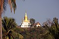
changeLaos is the only landlocked country in Southeast Asia. The landscape is mostly rugged mountains. The highest point is Phou Bia at 2,818 metres (9,245 feet). The Mekong River forms the border with Thailand. The mountains of the Annamite Range form the eastern border with Vietnam. The climate is tropical. The rainy season is from May to November. The dry season is from December to April. Laos has three seasons (rainy, cold and hot). The capital and largest city is Vientiane.
History
changeFa Ngum created the first unified Lao Kingdom.
Lao became a French colony in 1893 and also became part of French Indochina. In 1949 it became independent from France, as the Kingdom of Laos. The Laotian Civil War started in 1953. In 1975 Laos became a one-party state under the leadership of the communist party.[7]
Laotian Civil War
changeThe civil war in Laos started on November 9, 1953.
The Pathet Lao started its conflict with the Kingdom of Laos on November 9, 1953. That was the start of the Laotian Civil War. Before that (April 1953), the PAVN put in place a siege of a north-eastern part of the French protectorate Laos. That force had 40,000 soldiers who were under Võ Nguyên Giáp (a general), including 2,000 Pathet Lao soldiers under Suphānuvong (or prince Souphanouvong).
Against those soldiers, were 10,000 Laotian soldiers and 3,000 French soldiers.
On July 20, 1954 an agreement was signed - Agreement on the Cessation of Hostilities in Laos. That agreement ended France's rule of Laos.[8] Two months later, the authorities of North Vietnam, established a support group for Pathet Lao, in Ban Nameo[9] in north-eastern Laos.

From 1955 til 1958, the conflict level was reduced (or became smaller). A general election was held for the first time (1955). A coalition government was formed, with Souvanna Phouma (a prince) as its leader. He was the prime minister from March 21, 1956 to August 17, 1958.
On December 25, 1959 there was a coup d'état. Its leader was Phoumi Nosavan (a general).
On August 9, 1960 there was another coup d'état. Its leader was the chief (Kong Le) of Parachute Battalion 2 of the Royal Laotian Army.[10] Parachute Battalion 2 were being trained with the help of an employee of the CIA, Jack Mathews, and instructors from the US Special Forces.[11] The coup d'état happened without the CIA employee, knowing about it. The government of Somsanith was pushed out of power.[12] The government resigned on August 14.[13] Laotian soldiers gave orders (or said) that Americans must leave Laos.
The coalition government under Souvanna Phouma, was in office from August 30, 1960 – December 13, 1960.
On November 21, 1960, general Phoumi tried to take power, by trying to take over the capital Vientiane;[14]
After the Battle of Vientiane
changeThe Battle of Vientiane happened between December 13, 1960 and December 16. The right wing politicians under Phoumi Nosavan, came into power.
Military training was given to some groups of people, during Operation Momentum. The operation was planned by the CIA. It started in January 1961 (and ended in 1974).
One of the groups that were trained, were Hmong. The soldiers of Operation Momentum did fight against the soldiers of Pathet Lao and North Vietnam. The operation was led by Vang Pao (laotian officer and Hmong). The operation had trained 5,000 soldiers by May 1, 1961, and 9,000 by August.
The Battle of Ban Pa Dong (between January 31 and June 6, 1961) was lost by Vang Pao's forces against North Vietnamese and the Pathet Lao. The place was where Vang Pao's [so-called secret army or] L'Armee Clandestine had trained its first 5,000 soldiers. The headquarters for Vang Pao were moved to Long Tieng,[15] until the end of the war.[16]
Child soldiers were used during the war.[17]
After the agreement in Geneva in 1962
changeAn agreement in Geneva (on July 23, 1962) said that Laos was a neutral country. (The agreement was the end of the conference that started on May 16, 1961: International Conference on the Settlement of the Laotian Question.) Vietnam and the United States did not respect the agreement.
The Battle of Lak Sao happened between November 1963 and January 1964.
From the middle[18] of the 1960s, Laos was used by North Vietnam as a route to attack South Vietnam. U.S. forces dropped a lot of bombs on Laos, to try to stop the supplies coming thru the Ho Chi Minh trail.
There were two coup attempts against the coalition government of Souvanna Phouma, in 1964; Until the end of the civil war, Souvanna Phouma supported the right-wing that kept him in power, and he was against the communists.[19][20]
In 1968, the Pathēt Lao was pushed to the side by the NVA, and the NVA did the fighting. In January 1968 the Laotian forces, supported by the U.S. military, lost the Battle of Nam Bac. (In January, North Vietnam sent their 316th Division towards the Nam Bac valley; The 7 best military units of Laos, stayed at a military base there; The base was lost.) The Royal Laotian Army did not have much military power for the next years; Units larger than battalion, were broken up. The authorities of Laos pulled out of the conflict.

During the rain season in 1969, Vang Pao's forces took all of the Plain of Jars (Thong Hay Hin).[21]
The third Battle of Skyline Ridge (near the Long Chen military base where Vang Pao had his headquarters), took place from December 1971 to February 1972; Around 2,000 soldiers (Hmong, Thai and Laotian soldiers) were killed, and so where 10,000 NVA soldiers.[21]
Many B-52 bombers dropped bombs on Laos, during different bombing runs.[22]
After the peace agreement in Paris
changeIn January 1973, a peace agreement between North Vietnam and the U.S. became known; The agreement made Suphānuvong a de facto co-ruler of Laos.
A new coalition government was formed after the peace agreement (in Paris) that was to end the Vietnam War. From February[21] 1973 there was a truce between Pathet Lao and the government. However, North Vietnam forces were still in the country, and had an important influence on the Pathet Lao.
South Vietnam was taken (or fell) in April 1975. On May 14, 1975 Vang Pao escaped from Laos, thru the military base at Long Tieng.[23] The base was lost to the Pathet Lao, the next day.[24]
Pathet Lao took control over Laos. On December 2, 1975, the king had to abdicate (or give up his power). The People's republic of Laos was proclaimed.
Provinces
changeLaos is divided in 16 provinces and one prefecture.
| Number | State | Capital | Area (km²) | Population |
|---|---|---|---|---|
| 1 | Attapeu | Attapeu | 10,320 | 114,300 |
| 2 | Bokeo | Ban Houayxay | 6,196 | 149,700 |
| 3 | Bolikhamsai | Paksan | 14,863 | 214,900 |
| 4 | Champasak | Pakse | 15,415 | 575,600 |
| 5 | Hua Phan | Xam Neua | 16,500 | 322,200 |
| 6 | Khammouane | Thakhek | 16,315 | 358,800 |
| 7 | Luang Namtha | Luang Namtha | 9,325 | 150,100 |
| 8 | Luang Phrabang | Luang Phrabang | 16,875 | 408,800 |
| 9 | Oudomxay | Muang Xay | 15,370 | 275,300 |
| 10 | Phongsali | Phongsali | 16,270 | 199,900 |
| 11 | Sayabouly | Sayabouly | 16,389 | 382,200 |
| 12 | Salavan | Salavan | 10,691 | 336,600 |
| 13 | Savannakhet | Savannakhet | 21,774 | 721,500 |
| 14 | Sekong | Sekong | 7,665 | 83,600 |
| 15 | Vientiane | Vientiane | 3,920 | 726,000 |
| 16 | Vientiane | Muang Phon-Hong | 15,927 | 373,700 |
| 17 | Xieng Khouang | Phonsavan | 15,880 | 229,521 |
Government and politics
changeLaos is one of the world's five remaining communist states. The only legal political party is the Lao People's Revolutionary Party (LPRP). The head of state is President Choummaly Sayasone. He is the General Secretary of the Lao People's Revolutionary Party.
Shortly after the end of the Vietnam War, the North Vietnamese Army (NVA) joined forces with the Pathet Lao, started a coup on December 2, 1975 to overthrow the royalist Lao government, and established a communist government that continues to run the country to this day.
The current head of government is Prime Minister Sonexay Siphandone and the current President is Thongloun Sisoulith. Government policies are determined by the party. Important government decisions are checked by the Council of Ministers.
- Laos
-

-
-
-

-
-
-

-

-


Related pages
changeReferences
change- ↑ "Background notes – Laos". US Dept. of State. Retrieved 20 January 2011.
- ↑ 2.0 2.1 2.2 2.3 "Laos". International Monetary Fund. Retrieved 30 April 2011.
- ↑ "Human Development Report 2009. Human development index trends: Table G" (PDF). The United Nations. January 2009. Retrieved 5 October 2009.
- ↑ "The World Factbook: Laos". 1 March 2011. CIA World Factbook. Archived from the original on 29 December 2010. Retrieved 12 March 2011.
- ↑ "Population density in South East Asia". TheGlobalEconomy.com. Retrieved 2023-03-22.
- ↑ https://www.bangkokpost.com/thailand/general/2822566/bangkok-vientiane-train-service-begins-july-19. Retrieved 2024-07-03
- ↑ "Laos country profile". 7 February 2011. BBC News. Retrieved 12 March 2011.
- ↑ https://web.archive.org/web/20041031095421/http://lcweb2.loc.gov/cgi-bin/query/r?frd%2Fcstdy%3A%40field%28DOCID%2Bla0004%29
- ↑ https://web.archive.org/web/20170904014932/http://lcweb2.loc.gov/cgi-bin/query/D?cstdy%3A1%3A.%2Ftemp%2F~frd_6n5k%3A%3A
- ↑ Before the Quagmire:American Intervention in Laos, 1954-1961. William J. Rust. 2012. ISBN 978-0-8131-3578-6. s. 175
- ↑ Before the Quagmire: American Intervention in Laos, 1954-1961. William J. Rust. s. 176
- ↑ Before the Quagmire: American Intervention in Laos, 1954-1961. William J. Rust. s. 175
- ↑ Before the Quagmire: American Intervention in Laos, 1954-1961. William J. Rust. s. 181
- ↑ Warner, Roger (1995). Back Fire: The CIA's Secret War in Laos and Its Link to the War in Vietnam. Simon & Schuster. ISBNs 0-68480-292-9, 978-06848-0292-3. Pages 26–29.
- ↑ Anthony, Victor B. and Richard R. Sexton (1993). The War in Northern Laos. Command for Air Force History. OCLC 232549943. P. 54.
- ↑ Castle, Timothy N. (1993). At War in the Shadow of Vietnam: U.S. Military Aid to the Royal Lao Government 1955–1975. ISBN 0-231-07977-X. P. 42.
- ↑ Peter Lang-Stanton. https://www.bbc.com/news/world-us-canada-42314701. BBC.com. Retrieved 2023-07-28
- ↑ "By the mid-60s, Laos had become a theater for the U.S. to cut off the Ho Chi Minh Trail, largely through bombing. They basically viewed their Laotian allies as an anvil to hammer the North Vietnamese. "
- ↑ Fall, Bernard (1969). Anatomy of a Crisis: The Laotian Crisis of 1960–1961. Doubleday & Co. ASIN: B00JKPAJI4. p. 234. Note: This Epilogue page written by Roger M. Smith.
- ↑ http://nsarchive.gwu.edu/NSAEBB/NSAEBB284/6-UNDERCOVER_ARMIES.pdf s. 192
- ↑ 21.0 21.1 21.2 The secret war - Mekong Review
- ↑ "Hitting the Pathet Lao in the north and on the Ho Chi Minh trail in the south, the American air force unleashed an average of one attack every eight minutes for nearly ten years. "
- ↑ https://www.nytimes.com/2015/05/28/opinion/heirs-of-the-secret-war-in-laos.html?_r=0
- ↑ Thompson, 57–58; See also Morrison, Gayle, L. Sky is Falling: an Oral History of the CIA's evacuation of the Hmong from Laos, Jefferson, North Carolina: McFarland, 1999