Toronto
Toronto is the capital city of the province of Ontario. It is also the largest city in Ontario. It is found on the north-west side of Lake Ontario behind New York City and Chicago.
Toronto | |
|---|---|
| City of Toronto | |
From top, left to right: Downtown Toronto and the CN Tower viewed from Harbourfront, the Ontario Legislative Building, City Hall with the 3D Toronto sign, Humber Bay Arch Bridge, Casa Loma, the Royal Ontario Museum and the Scarborough Bluffs | |
| Etymology: From the Mohawk word tkaronto, the name of a channel between Lakes Simcoe and Couchiching | |
| Nickname: See Name of Toronto | |
| Motto: | |
 Interactive map of Toronto | |
 Toronto Location of Toronto in Ontario | |
| Coordinates: 43°44′30″N 79°22′24″W / 43.74167°N 79.37333°W | |
| Country | Canada |
| Province | Ontario |
| Settled | 1750 (as Fort Rouillé)[4] |
| Established | August 27, 1793 (as York) |
| Incorporated | March 6, 1834 (as Toronto) |
| Amalgamated into division | January 20, 1953 (as Metropolitan Toronto) |
| Amalgamated | January 1, 1998 (as City of Toronto) |
| Districts | |
| Government | |
| • Type | Single-tier municipality with a mayor–council system |
| • Mayor | John Tory |
| • Deputy Mayors[5][6] | |
| • Body | Toronto City Council |
| • Federal representation | List of MPs |
| • Provincial representation | List of MPPs |
| Area | |
| • City | 630.20 km2 (243.32 sq mi) |
| • Urban | 1,792.99 km2 (692.28 sq mi) |
| • Metro | 5,905.71 km2 (2,280.21 sq mi) |
| Elevation | 76.5 m (251.0 ft) |
| Population | |
| • City | 2,731,571 (1st) |
| • Density | 4,334.4/km2 (11,226/sq mi) |
| • Urban | 5,429,524[10] |
| • Greater Toronto Area (metro) | 6,417,516 (1st) |
| • Region | 9,245,438 |
| Demonym | Torontonian |
| Time zone | UTC−5 (EST) |
| • Summer (DST) | UTC−4 (EDT) |
| Postal code span | |
| Area codes | 416, 647, 437 |
| Major airports | Toronto Pearson International Airport, Billy Bishop Toronto City Airport |
| Highways | 2A, 27, 400, 401, 404, 409, 427, Black Creek Drive, Allen Road, Don Valley Parkway, Gardiner Expressway, Queen Elizabeth Way |
| Rapid transit | Toronto subway |
| Commuter rail | GO Transit |
| Waterways | Black Creek, Burke Brook, Don River, Etobicoke Creek, German Mills Creek, Humber River, Keating Channel, Mimico Creek, Rouge River, Taylor-Massey Creek |
| GDP (Toronto CMA) | CA$385.1 billion (2016)[12] |
| GDP per capita (Toronto CMA) | CA$57,004 (2016) |
| Website | toronto |


.jpg)

.jpg)


The City of Toronto itself has a population of almost 3 million people. Even more people live in the regions around it. All together, the Greater Toronto Area is home to over 6 million people. This makes it the biggest metropolitan area in Canada.
History change
Toronto was created in 1793 by John Graves Simcoe as the capital of what was then called "Upper Canada". At the time it was called the "Town of York" after the Duke of York. The name was changed to Toronto in 1834. With the Canadian Confederation in 1867, it became the capital of the newly created province of Ontario. Toronto was one of two cities (along with Montreal in Quebec) that wanted to be the capital of Canada. Queen Victoria decided that Ottawa should be the national capital because it was located between the two.
As the 19th century moved on, the city began to grow. This was mainly because of immigration, where people from all over the world left their home and moved to Canada. Many of the immigrants were Irish people. They brought their Catholic faith with them when they left Ireland because of the Irish Potato Famine.
During World War I and World War II, Toronto was used to train members of the Canadian Army. After the wars, even more immigrants came to the city. The population was becoming so big that the Government of Ontario decided to create Metropolitan Toronto in 1954, combining a number of local municipalities. These were Old Toronto, York, East York, North York, Etobicoke, and Scarborough.
By 1981, Toronto had more people than Montreal even though it was created after Montreal. Because of that, the Ontario government decided to make Toronto a "megacity" in 1998. The first mayor of Toronto was Mel Lastman. As Toronto moved into the 21st century, it became host to a number of worldwide events. These included World Youth Day in 2002, WorldPride in 2014, and the 2015 Pan American Games.
On April 23, 2018 a white van collided with numerous pedestrians killing nine and injuring sixteen others at Yonge Street.[13]
Climate change
Toronto has a hot-summer humid continental climate (Köppen climate classification: Dfa).
| Climate data for Toronto (The Annex), 1981–2010 normals, extremes 1840–present[b] | |||||||||||||
|---|---|---|---|---|---|---|---|---|---|---|---|---|---|
| Month | Jan | Feb | Mar | Apr | May | Jun | Jul | Aug | Sep | Oct | Nov | Dec | Year |
| Record high humidex | 15.7 | 12.2 | 21.7 | 31.6 | 39.8 | 44.5 | 43.0 | 42.6 | 43.8 | 31.2 | 26.1 | 17.7 | 44.5 |
| Record high °C (°F) | 16.1 (61.0) |
19.1 (66.4) |
26.7 (80.1) |
32.2 (90.0) |
34.4 (93.9) |
36.7 (98.1) |
40.6 (105.1) |
38.9 (102.0) |
37.8 (100.0) |
30.8 (87.4) |
23.9 (75.0) |
19.9 (67.8) |
40.6 (105.1) |
| Average high °C (°F) | −0.7 (30.7) |
0.4 (32.7) |
4.7 (40.5) |
11.5 (52.7) |
18.4 (65.1) |
23.8 (74.8) |
26.6 (79.9) |
25.5 (77.9) |
21.0 (69.8) |
14.0 (57.2) |
7.5 (45.5) |
2.1 (35.8) |
12.9 (55.2) |
| Daily mean °C (°F) | −3.7 (25.3) |
−2.6 (27.3) |
1.4 (34.5) |
7.9 (46.2) |
14.1 (57.4) |
19.4 (66.9) |
22.3 (72.1) |
21.5 (70.7) |
17.2 (63.0) |
10.7 (51.3) |
4.9 (40.8) |
−0.5 (31.1) |
9.4 (48.9) |
| Average low °C (°F) | −6.7 (19.9) |
−5.6 (21.9) |
−1.9 (28.6) |
4.1 (39.4) |
9.9 (49.8) |
14.9 (58.8) |
18.0 (64.4) |
17.4 (63.3) |
13.4 (56.1) |
7.4 (45.3) |
2.3 (36.1) |
−3.1 (26.4) |
5.9 (42.6) |
| Record low °C (°F) | −32.8 (−27.0) |
−31.7 (−25.1) |
−26.7 (−16.1) |
−15.0 (5.0) |
−3.9 (25.0) |
−2.2 (28.0) |
3.9 (39.0) |
4.4 (39.9) |
−2.2 (28.0) |
−8.9 (16.0) |
−20.6 (−5.1) |
−30.0 (−22.0) |
−32.8 (−27.0) |
| Record low wind chill | −37 | −34 | −26 | −17 | −8 | 0 | 0 | 0 | 0 | −8 | −17 | −34 | −37 |
| Average precipitation mm (inches) | 61.5 (2.42) |
55.4 (2.18) |
53.7 (2.11) |
68.0 (2.68) |
82.0 (3.23) |
70.9 (2.79) |
63.9 (2.52) |
81.1 (3.19) |
84.7 (3.33) |
64.4 (2.54) |
84.1 (3.31) |
61.5 (2.42) |
831.1 (32.72) |
| Average rainfall mm (inches) | 29.1 (1.15) |
29.7 (1.17) |
33.6 (1.32) |
61.1 (2.41) |
82.0 (3.23) |
70.9 (2.79) |
63.9 (2.52) |
81.1 (3.19) |
84.7 (3.33) |
64.3 (2.53) |
75.4 (2.97) |
38.2 (1.50) |
714.0 (28.11) |
| Average snowfall cm (inches) | 37.2 (14.6) |
27.0 (10.6) |
19.8 (7.8) |
5.0 (2.0) |
0.0 (0.0) |
0.0 (0.0) |
0.0 (0.0) |
0.0 (0.0) |
0.0 (0.0) |
0.1 (0.0) |
8.3 (3.3) |
24.1 (9.5) |
121.5 (47.8) |
| Average precipitation days (≥ 0.2 mm) | 15.4 | 11.6 | 12.6 | 12.6 | 12.7 | 11.0 | 10.4 | 10.2 | 11.1 | 11.7 | 13.0 | 13.2 | 145.5 |
| Average rainy days (≥ 0.2 mm) | 5.4 | 4.8 | 7.9 | 11.2 | 12.7 | 11.0 | 10.4 | 10.2 | 11.1 | 11.7 | 10.9 | 7.0 | 114.1 |
| Average snowy days (≥ 0.2 cm) | 12.0 | 8.7 | 6.5 | 2.2 | 0.0 | 0.0 | 0.0 | 0.0 | 0.0 | 0.08 | 3.1 | 8.4 | 40.9 |
| Mean monthly sunshine hours | 85.9 | 111.3 | 161.0 | 180.0 | 227.7 | 259.6 | 279.6 | 245.6 | 194.4 | 154.3 | 88.9 | 78.1 | 2,066.3 |
| Percent possible sunshine | 29.7 | 37.7 | 43.6 | 44.8 | 50.0 | 56.3 | 59.8 | 56.7 | 51.7 | 45.1 | 30.5 | 28.0 | 44.5 |
| Average ultraviolet index | 1 | 2 | 3 | 5 | 7 | 8 | 8 | 7 | 5 | 3 | 2 | 1 | 4 |
| Source 1: Environment Canada [18][19][20] | |||||||||||||
| Source 2: Weather Atlas (UV)[21] | |||||||||||||
Things to see and do change
Toronto has a humid continental climate (Dfa in the Köppen climate classification). This is because although the city is next to Lake Ontario, the lake is not big enough to keep its temperature mild.
As the biggest city in Canada and one of the biggest in all of North America, Toronto is a popular destination for tourists. It is where you can find the CN Tower, which is the tallest free-standing (not supported) structure in the Americas and one of the Seven Wonders of the Modern World. There are some other buildings, including the City Hall and the Rogers Centre, that are well known for their design style. There are many skyscrapers, because many large banks of Canada and other companies have their main offices in Toronto, and the Toronto Stock Exchange which is the biggest stock market in Canada.
Because Toronto is the capital of Ontario, it is where the provincial government meets. Visitors can see how the province is run by visiting the legislature in Queen's Park. There are museums, including the Royal Ontario Museum, the Art Gallery of Ontario, the Ontario Science Centre, the Hockey Hall of Fame, and the headquarters of the Canadian Broadcasting Corporation. In the suburbs of the city is the Toronto Zoo and Canada's Wonderland. Many visitors also like to go to Niagara Falls, just an hour's drive away from Toronto.
Toronto is full of places to visit, eat, shop, and enjoy. In the downtown area are shopping centres, including the Eaton Centre, St. Lawrence Market, and the Distillery District. There are several theatres, many which are run by the Mirvish family. The Four Seasons Centre for the Performing Arts, opened in June 2006, is home to the Canadian Opera Company and the National Ballet of Canada. Across the harbor are the Toronto Islands, the best known of which is Centre Island.
Toronto has many sports teams. Some of them belong to the most commonly-followed leagues in North America. They include the Toronto Maple Leafs in ice hockey (NHL) and the Toronto Raptors in basketball (NBA), both of which play in the Air Canada Centre. The nearby Rogers Centre is where the Toronto Blue Jays baseball team plays. BMO Field in Exhibition Place is home to the Toronto Argonauts in Canadian football and Toronto F.C., a soccer club.
Toronto is a very multicultural city. Different people from around the world have moved to Toronto to live since the 20th century. There is a Chinatown, Little Italy, Little Tokyo, Greektown, Little Portugal, and other places where different cultures are kept alive. These people hold festivals where they share their culture with others. Among the most popular is the Canadian National Exhibition (CNE), which happens every year in August.
Transport change
Like many cities around the world, Toronto has an airport, Toronto Pearson International Airport. There are flights to many places in Canada and the rest of the world. The airport is just northwest of the city centre. Since 2015, there has been a train service, the Union Pearson Express. It goes from the airport to Downtown in less than half an hour.
Toronto's main public transportation system is operated by the Toronto Transit Commission (TTC). The main part of its public transport network is the Toronto subway system. That system includes three heavy-rail rapid transit lines spanning the city, including the U-shaped Line 1 and east–west Line 2. A light metro line also exists, exclusively serving the eastern district of Scarborough. A discussion is underway[when?] to replace it with a heavy-rail line. The TTC also operates an extensive network of buses and streetcars. The streetcars serve the downtown core. The buses provide service to many parts of the city not served by the sparse subway network.
The Government of Ontario also operates a commuter rail and bus transit system called GO Transit in the Greater Toronto Area. GO Transit carries over 250,000 passengers every weekday (2013) and 57 million annually. Most of them travel to or from Union Station. GO Transit is implementing RER (Regional Express Rail) into its system.
Housing change
Housing in Toronto was ranked as 10th-least affordable in the world. The study compared Toronto with ninety other metropolitan areas in different countries. Hong Kong came in as the least affordable place to live in.[22]
Gallery change
-
 The CN Tower, as seen from the Rogers Centre during a baseball game.
 -
 The Ontario Legislature is where the provincial government meets.
 -
 Toronto City Hall, where the city government meets, is on the left. On the right is Old City Hall, which is now an appeals court.
 -
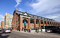 The St. Lawrence Market is a busy indoor market. Many people buy fresh produce, meat, and seafood here.
 -
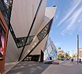 There are many museums in Toronto, such as the Royal Ontario Museum.
 -
 The Hockey Hall of Fame is a museum about ice hockey and many of its famous players.
 -
 Toronto's 3 distinct Chinatown is one of many places where immigrants live and their culture is kept alive.
 -
-
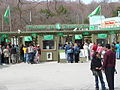 In Scarborough, a suburb of Toronto, there is the Toronto Zoo, where many animals are taken care of.
 -
 Yorkdale Shopping Centre is just one of many large shopping malls outside downtown Toronto.
 -
 This is Mississauga, one of the cities near Toronto where people live. They commute to work in Toronto.
 -
 Niagara Falls is a popular tourist attraction not far from Toronto.


.jpg)


Media change
TV stations change
| OTA virtual channel (PSIP) | OTA channel | Rogers Cable | Bell Fibe TV | Call Sign | Network | Notes |
|---|---|---|---|---|---|---|
| 5.1 | 20 (UHF)) | 6 | 205 | CBLT-DT | CBC Television | |
| 11.1 | 15 (UHF) | 12 | 12 | CHCH-DT | Independent | |
| 9.1 | 9 (VHF) | 8 | 201 | CFTO-DT | CTV | |
| 3.1 | 3 UHF | 10 | 10 | CKVR-DT | CTV 2 | |
| 19.1 | 19 (UHF) | 2 | 209 | CICA-DT | TVOntario | Provincial public educational broadcaster |
| 57.1 | 44 (UHF) | 7 | 204 | CITY-DT | Citytv | |
| 41.1 | 41 (UHF) | 3 | 203 | CIII-DT | Global | |
| 47.1 | 47 (UHF) | 4 | 206 | CFMT-DT | Omni Television (OMNI 1) | Multicultural (America) |
References change
- ↑ "History of City Symbols". www.toronto.ca. City of Toronto. 2020. Retrieved October 27, 2020.
- ↑ Harzig, Christiane; Juteau, Danielle; Schmitt, Irina (2006). The Social Construction of Diversity: Recasting the Master Narrative of Industrial Nations. Berghahn Books. p. 310. ISBN 978-1-57181-376-3.
In reflecting and capturing this sense of the city, one of the first actions of the newly amalgamated Toronto City Council in 1998 was to adopt "Diversity Our Strength" as its official motto.
- ↑ City of Toronto Government (18 August 2017). "Equity, Diversity & Inclusion". Retrieved October 27, 2020.
- ↑ "The real story of how Toronto got its name | Earth Sciences". Geonames.nrcan.gc.ca. September 18, 2007. Archived from the original on December 9, 2011. Retrieved February 10, 2012.
- ↑ "Mayor reveals new appointments as a cut-down council focuses on big issues". CBC News. December 12, 2018. Archived from the original on December 26, 2018. Retrieved March 8, 2019.
- ↑ Artuso, Antonella (December 12, 2018). "Tory makes his picks for deputy mayors, committee chairs". Toronto Sun. Archived from the original on March 27, 2019. Retrieved March 8, 2019.
- ↑ "(Code 3520005) Census Profile". 2016 census. Statistics Canada. 2017. Retrieved 2017-02-12.
- ↑ "Population and dwelling counts, for population centres, 2011 and 2006 censuses". 2011 Census of Population. Statistics Canada. January 13, 2014. Archived from the original on October 26, 2014. Retrieved December 11, 2014.
- ↑ "Population and dwelling counts, for census metropolitan areas, 2011 and 2006 censuses". 2011 Census of Population. Statistics Canada. January 13, 2014. Archived from the original on June 22, 2012. Retrieved December 11, 2014.
- ↑ "Population and Dwelling Count Highlight Tables, 2016 Census". 8 February 2017.
- ↑ "Census Profile, 2016 Census". www12.statcan.gc.ca. Statistics Canada. 8 February 2017.
- ↑ "Statistics Canada. Table 36-10-0468-01 Gross domestic product (GDP) at basic prices, by census metropolitan area (CMA) (x 1,000,000)". Statistics Canada. 27 January 2017.
- ↑ Austen, Ian; Stack, Liam (April 23, 2018). "Toronto Van Plows Along Sidewalk, Killing 9 in 'Pure Carnage'". The New York Times. Retrieved April 23, 2018.
- ↑ "Monthly Data Report for 1840". Canadian Climate Data. Environment Canada. June 22, 2016. Climate ID: 6158350. Retrieved July 15, 2016.
- ↑ "Monthly Data Report for 2003". Canadian Climate Data. Environment Canada. June 22, 2016. Climate ID: 6158350. Retrieved July 15, 2016.
- ↑ "Monthly Data Report for 2003". Canadian Climate Data. Environment Canada. June 22, 2016. Climate ID: 6158355. Retrieved July 15, 2016.
- ↑ Shum, David; Miller, Adam (February 23, 2017). "Toronto breaks warmest February day ever recorded". Global News.
- ↑ "The Annex". 1981 to 2010 Canadian Climate Normals. Environment Canada. February 13, 2014. Climate ID: 6158350. Retrieved February 24, 2014.
- ↑ "Daily Data Report for October 2007". Canadian Climate Data. Environment Canada. June 22, 2016. Climate ID: 6158355. Retrieved July 15, 2016.
- ↑ "Daily Data Report for February 2017". Canadian Climate Data. Environment Canada. August 9, 2016. Climate ID: 6158355. Retrieved February 24, 2017.
- ↑ d.o.o, Yu Media Group. "Toronto, Canada - Detailed climate information and monthly weather forecast". Weather Atlas. Retrieved 2019-07-05.
- ↑ Why Ottawa’s attempts to help young Canadians afford housing simply won’t work | Financial Post
- ↑ The motto is typically rendered without punctuation, while the city's coat of arms uses typographical bullets to space the words used in the motto. However, some sources from the municipal government of Toronto renders the motto with punctuation, as "Diversity, Our Strength."[3]
- ↑ Maximum and minimum temperature data at The Annex was recorded by human observers from March 1840 to June 2003 under the station name "TORONTO".[14][15] From July 2003 to present, climate data has been recorded by an automatic weather station under the name "TORONTO CITY".[16][17]
Other websites change
- City of Toronto - Official city website.
- Tourism Toronto Archived 2006-04-09 at the Wayback Machine - Visitor's bureau website.